
Trace The Eastern Continental Divide Through West Virginia With These 4 Geographically Significant Stops
×

Cristy
Author
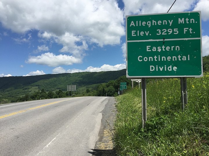
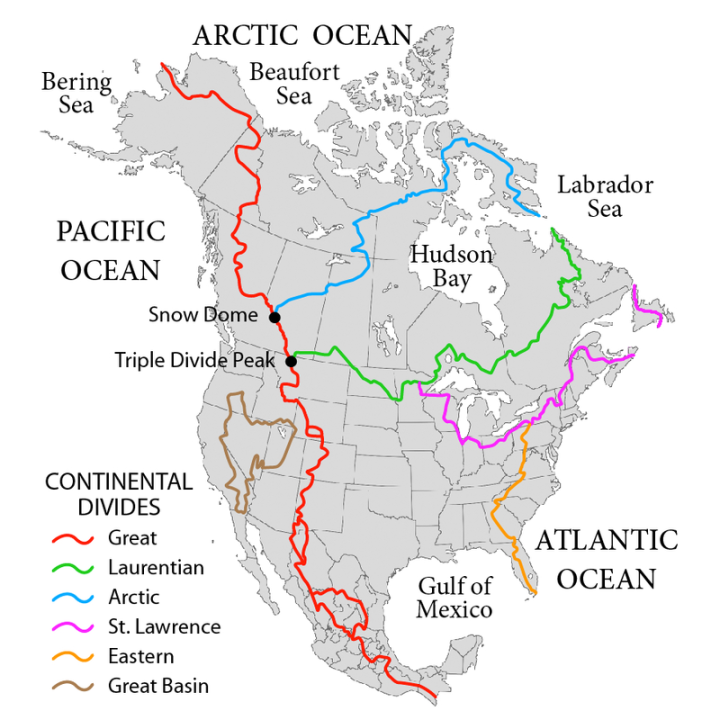
There are six major ridgelines in North America that divide and direct the rivers of the continent toward their final gulf and ocean destinations. One of the six, the Eastern Continental Divide, cuts through the state of West Virginia.
How can this be? It's thanks to the Eastern Continental Divide, which runs through West Virginia and serves as the hydrographic divide for the rivers of eastern North America, directing some toward the Gulf of Mexico and some toward the Atlantic Ocean.
Advertisement

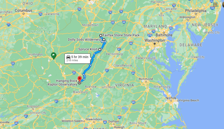
Fairfax Stone Road, Fairfax Stone Rd, West Virginia, USA
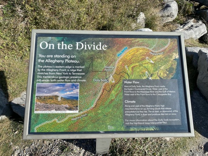
The Eastern Divide stretches from Lake Ontario in the north to Florida in the south. In West Virginia, it passes just above the Fairfax Stone (the source of the Potomac) and then divides the Canaan Valley/Cheat River watershed from the Mount Storm Lake/Potomac River watershed.
Advertisement
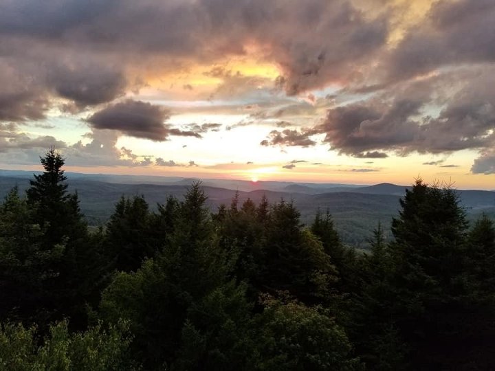
Dolly Sods Wilderness, West Virginia 26260, USA
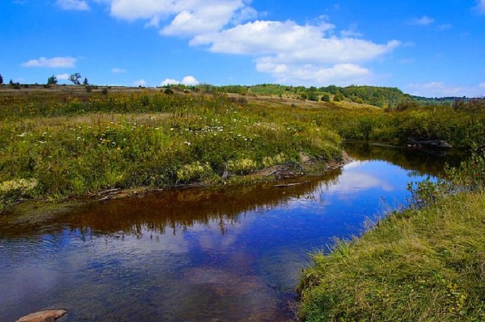
Eventually, the divide joins the Allegheny Front through Dolly Sods (separating Red Creek, pictured, which flows into the Gulf of Mexico via the Ohio River...
Related Stories

This Speakeasy Hidden In A Bed & Breakfast In West Virginia Is Perfect For A Date Night
One Of The Country's Most Impressive Rest Stops Is Hiding Right Here In West Virginia

The Whole Family Could Spend An Entire Day Having A Blast At Reed's In West Virginia

...from Seneca Creek, pictured, which flows into the Atlantic Ocean via the Potomac River. Both Red Creek and Seneca Creek have their source on the divide itself in the Dolly Sods Wilderness Area).
Spruce Knob, West Virginia, USA
The divide then moseys on over the state's highest peak, Spruce Knob, and traces south along the West Virginia/Virginia border.

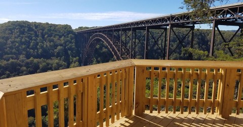
Hanging Rock Raptor Observatory, Union, WV, USA
Finally, it reaches Peters Mountain and the Hanging Rock Raptor Observatory before exiting into Virginia, on its way toward Blacksburg.
Also watch for signage about the divide on Route 3 coming into Gap Mills.
Advertisement
Historically (way back in 1763, when West Virginia was part of Virginia), the divide served another crucial purpose as well. It represented the western limit of the 13 original colonies.
Follow this geographically significant route along the Eastern Continental Divide for yourself using this customized Google Map.
OnlyInYourState may earn compensation through affiliate links in this article. As an Amazon Associate, we earn from qualifying purchases.