The Bridge Hike In Virginia That Will Make Your Stomach Drop
By Beth|Published January 22, 2017
×
Beth
Author
A lifelong Virginia resident, Beth loves exploring different parts of the world and currently resides in Charlottesville. She holds a degree in English Literature and one of her short stories has been featured in the Shenandoah Review. Other interests include hiking, songwriting, and spending time in the mountains.
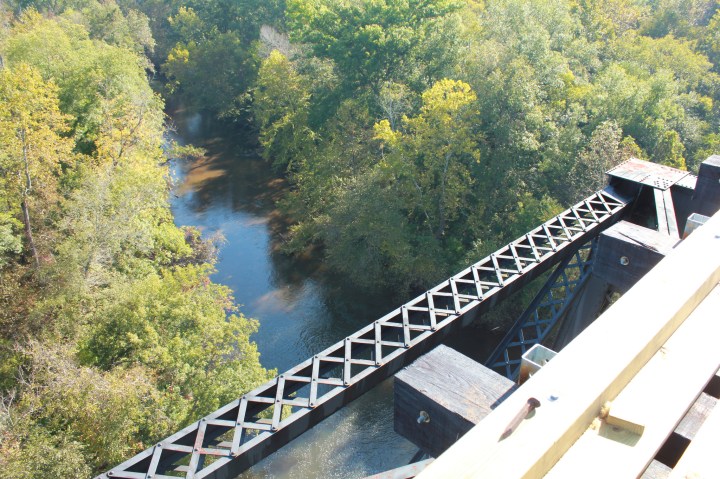
Hiking in Virginia is an activity that everyone can enjoy, from downright daredevils to easygoing nature enthusiasts. That’s because Virginia’s terrain lends itself to such a variety of hikes just waiting to be discovered. One trail, located just outside of Farmville, seems to combine both extremes. For one, it soars over 100 feet above the Appomattox River, providing a thrilling and stomach-dropping view to hikers. Yet at the same time, it’s a straight-shot trail that’s quite easy to walk. Here’s more on High Bridge Trail and why you’ll want to go.
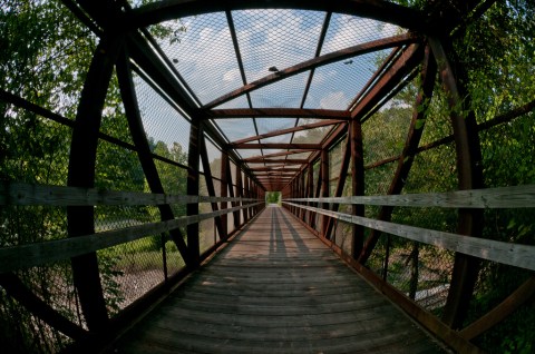
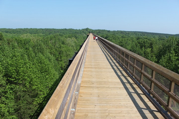
Welcome to the historic High Bridge Trail State Park, a picturesque Virginia landmark located just a short drive from Richmond.
Farmville’s High Bridge Trail is located in the aptly named High Bridge Trail State Park. The trail has been open for less than 10 years, but the bridge itself has quite an extensive history.
Advertisement
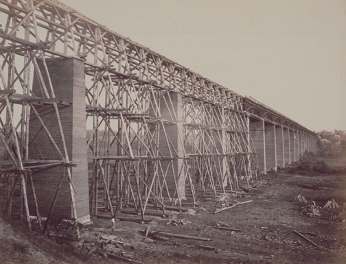
The original bridge dates back nearly 200 years, and began as a railway.
High Bridge was constructed in 1854 as a railway to span the Potomac River and connect the cities of Petersburg and Lynchburg. Building this structure was no easy feat. Originally made of wood, the bridge stood on 20 brick piers and spanned 2,400 feet.
Advertisement
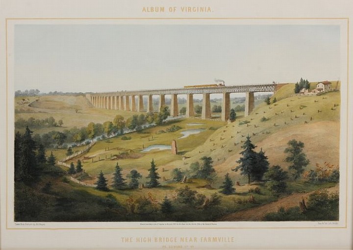
In its day, High Bridge Trail has born witness to much of Virginia’s history.
The bridge played a major role in the Civil War and in April of 1865, Confederates burned it down to prevent Union troops from crossing. Shortly after the Battle of High Bridge and the eventual Appomattox surrender, General Lee ordered the same men who burned the bridge to begin rebuilding it.
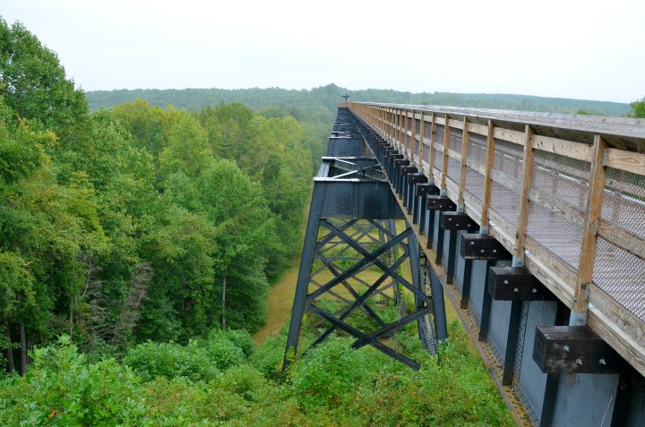
After much restoration, the bridge can be enjoyed today by hikers, bikers, and even horseback riders.
The bridge was restored by September and trains continued to cross High Bridge until October
of 2004. The rail was donated to the Virginia Department of Conservation and Recreation, and the rest is history.
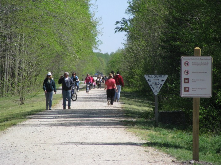
The trail which features High Bridge ranges over 30 miles, but with several access points, the trek can easily be modified.
Remaining flat for nearly the entire 30 miles, the trail itself isn’t very strenuous. Made mostly of crushed limestone, the pathway is wide and easy to navigate with plenty of signage.
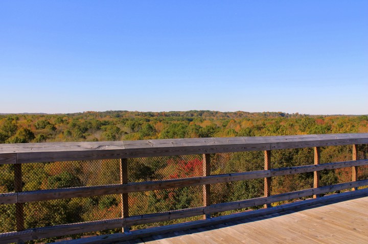
At its highest point, the bridge is 125 feet tall. Fortunately, the side rails provide plenty of sturdy support, but anyone with a phobia of heights might find this to be something of a challenge.
But once you've made your way all the way across, you'll feel quite a sense of accomplishment.
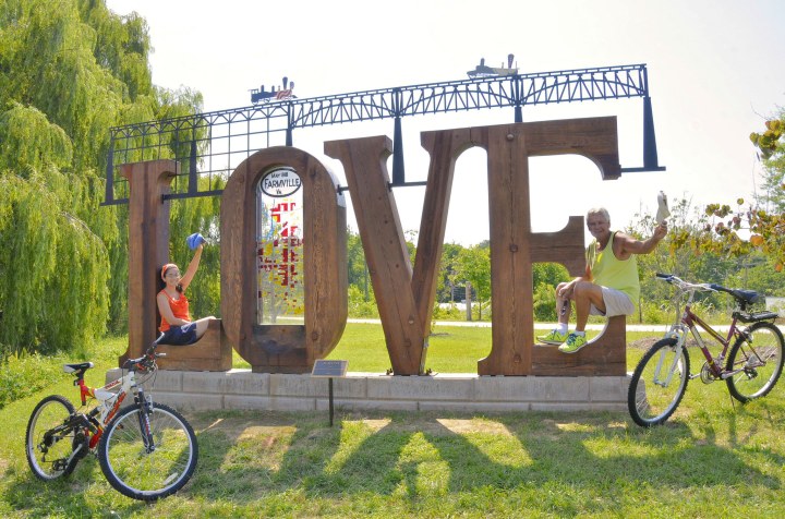
After you've conquered your fear of heights and tackled the bridge, make sure to get a photo by this famous Love Works sign!
Since there are so many entrances to the park, click here to learn more about directions. Have you visited High Bridge Trail State Park? We’d love to hear from you! For another unique adventure, be sure to check out Virginia’s Canopy Walk.
OnlyInYourState may earn compensation through affiliate links in this article. As an Amazon Associate, we earn from qualifying purchases.