18 Best Hikes In Southern California: Top-Rated Hiking Trails to Visit In 2024
There’s no doubt that Southern California has some of the best weather in the country. With comfortable, mild temperatures almost year-round close to the coast, for outdoor enthusiasts, it’s the best! Of course, SoCal also has deserts and mountains so hiking in these areas looks a bit different depending on the time of year. If you’re up for adventure in the great outdoors, here are 18 of the best hikes in Southern California!
Best Hikes in Southern California
While we all have different opinions on what’s best for just about anything, the following trails are highly rated by hikers. These are among the best-known and most popular trails for hiking in Southern California.
1. Mount Rubidoux Trail
- Location: Riverside
- Mileage 3.2-mile loop trail
- Difficulty: Easy
- FYI: This paved trail at Mount Rubidoux Park is wheelchair and stroller-friendly. There's an overall elevation gain of 501 feet and will take about 1.5 hours to complete. Dogs on leash are welcome. The parking lot off Tequesquite Avenue has 4 accessible spots.
The easy Mount Rubidoux Trail is paved and one the whole family can enjoy. Not only is it scenic but there are a few of points of interest along the way including a tall white cross and an American flag at the summit as well as a stone tower and a bridge. Between the ease of the pathway and the scenery, it's no wonder why this is such a popular trail!
2. Echo Mountain via Sam Merrill Trail
- Location: Altadena
- Mileage 5.5-mile out-and-back trail
- Difficulty: Moderate
- FYI: Located in Angeles National Forest, this is a somewhat challenging route with an elevation gain of 1,417 feet. This popular trail will take over 3 hours to complete and has some narrow switchbacks along the way. Dogs on leash are welcome.
If you enjoy an interesting hike with history, this trek to Echo Mountain is for you! Along the trail, you'll encounter the ruins of a former resort. Built in 1894 by Professor Thaddeus Lowe, this was meant to be a premier vacation destination. A railroad was even built in order to get guests up to the mountain hotel from below. You'll also see remnants of the railroad as well.
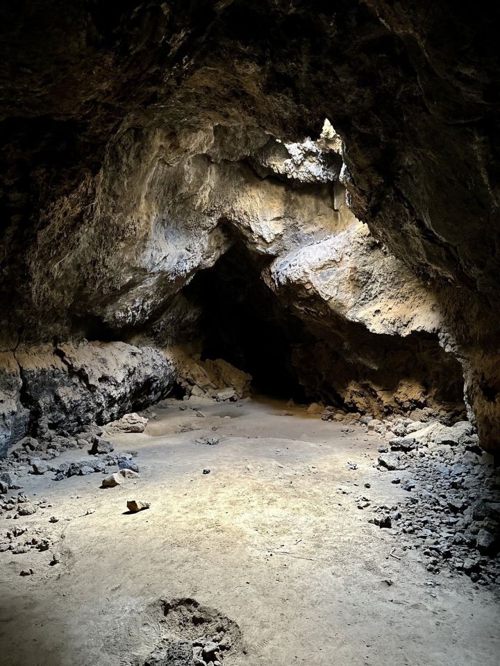
3. Lava Tube Trail
- Location: Baker
- Mileage 0.5-mile out-and-back trail
- Difficulty: Easy
- FYI: This popular trail is located in the Mojave National Preserve. The road getting to the trailhead is a bit rough so plan accordingly (a 4x4 vehicle is ideal). Bring a flashlight or headlamp with you to explore the lava tube. Dogs on leash are allowed here.
This trail may be short but it certainly gets points for creativity! The Lava Tube Trail is unique as can be as you'll have access to a cave that was formed by lava. A headlamp or flashlight is necessary if you intend on exploring the cave -- it's dark inside! Hikers have also reported seeing a bat and a rattlesnake inside the lava tube so you will want to exercise caution inside.
Best Short & Easy Hikes in Southern California
You don’t always have to trek too far to get some fresh air and exercise while taking in the scenery. And if you have children in tow, a short and easy hike is usually the best to get them outside to explore. Here are some of the best short and easy hikes in Southern California:
4. Torrey Pines Beach Trail Loop
- Location: Del Mar
- Mileage 2.3-mile loop trail
- Difficulty: Easy
- FYI: Torrey Pines State Natural Reserve charges a fee to park at the main parking lot but you may luck out and find street parking. There are some stairs along the trail so wear proper footwear so you don't slip. Also, check the tide before coming here as it is a true walk along the beach. Dogs are not allowed in the park so leave them at home.
Set aside at least an hour to hike this stunning trail at Torrey Pines State Natural Reserve. However, I have a feeling you'll want to spend more than an hour here! This area is popular among birdwatchers so be on the lookout and see how many species you can spot. The cliffs and the scenery are so jaw-dropping here it'll quickly become your favorite place in SoCal.
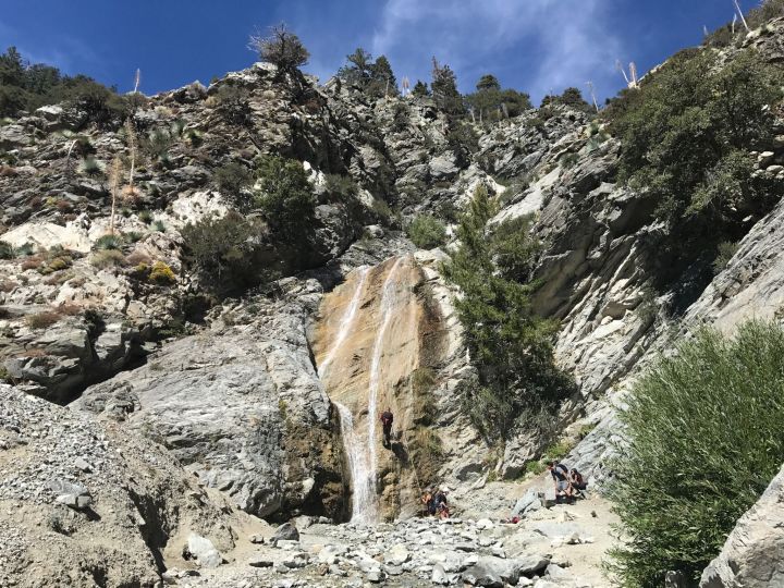
5. San Antonio Falls Trail
- Location: Mount Baldy
- Mileage 1.4-mile out-and-back trail
- Difficulty: Easy
- FYI: This trail is located within the Angeles National Forest. An Adventure Pass must be purchased and displayed in vehicles for recreation purposes in the National Forest. This trail is best from May through October. Dogs on leash are permitted.
This hike in the Angeles National Forest is enough for most people so feel free to bring the kids along. They would love to see the waterfall along the trail which is partially paved. This is a popular trail as it is so accessible so you'll have plenty of company as you hike.
6. Point Loma Tide Pools and Coastal Trail
- Location: San Diego
- Mileage 1-mile out-and-back trail
- Difficulty: Easy
- FYI: Cabrillo National Monument has an entrance fee of $20 per vehicle, $15 per motorcycle, and $10 per person. There are several stairs along the trail and parts of the trail can be slippery. Dogs are not allowed so leave them at home.
The Point Loma Tide Pools and Coastal Trail is as picturesque as you'd hope a coastal trail would be. While the trail itself only takes about 25 minutes to complete, you'll probably be hanging out here for several hours. Kids will love to explore the tide pools while adults will love the scenic bluff views. You'll also be able to see the New Point Loma Lighthouse from the trail.
Hardest Hikes in Southern California
Some people really like a challenge, especially a physical one that may also test one’s mental strength. For those who can endure both a steep climb to a higher elevation and a lengthy trek, try one of the hardest hikes in Southern California.
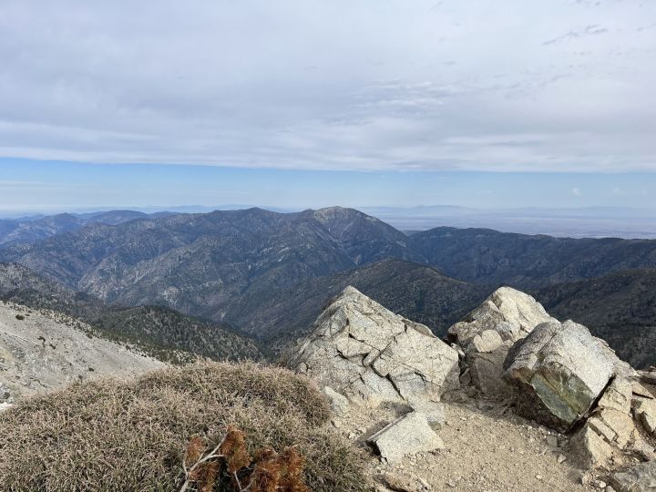
7. Wright Mountain via Manker Flat
- Location: Valyermo
- Mileage 14.7-mile out-and-back trail
- Difficulty: Hard
- FYI: This hike within the Angeles National Forest has an elevation gain of 8,654 feet and will take 13.5 hours to complete. The best time of year for this trail is between May and November. An Adventure Pass must be purchased and displayed in your vehicle.
Up for a challenge? Between the elevation gain and the length, the hike to Wright Mountain via the Manker Flat Campground is a doozie. It's best to overnight at the campground and break the hike up over the course of two or three days. The campground has 21 sites and is open year-round.
8. Deep Creek Hot Springs Trail
- Location: Hesperia
- Mileage 3.6-mile out-and-back trail
- Difficulty: Hard
- FYI: Located in the San Bernardino National Forest, an Adventure Pass must be purchased and displayed in your vehicle. The trail is open year-round and accessed from Bowen Ranch Road, however, a 4x4 vehicle is best and there is a fee of $10 per person to park. There is an elevation gain of 921 feet. Leashed dogs are allowed.
Located in the high desert with little shade along the way, it's imperative to bring sunscreen, a hat, and plenty of water. Deep Creek Hot Springs is fed by a spring and offer both cool and hot areas for soaking. Bring a swimsuit and a towel with you on this hike! Keep in mind, too, that the hike back to your car is mostly steep and uphill. Bring the appropriate gear and footwear with you. However, if you're up for the challenge this hike brings, your reward is a dip in the hot springs and, honestly, what could be better?
9. Agua Tibia Full Loop Trail
- Location: Temecula
- Mileage 19.3-mile loop trail
- Difficulty: Hard
- FYI: This hike in the Agua Tibia Wilderness has an elevation gain of 3,871 feet and will take 9.5 hours to complete. Leashed dogs are welcome. An Adventure Pass is required.
Here's where you get to do some mountain climbing. This trail leads up and over Aqua Tibia Mountain and is popular for a day hike, backpacking, and camping. If you intend to complete the trail in its entirety, consider camping overnight. You can try the Dripping Springs Campground which is also located within Aqua Tibia Wilderness. Hiking and camping? What an adventure!
Best Waterfront Hikes in Southern California
With hundreds of miles of coastline, it’s unsurprising that there are so many trails that run alongside the water. Just imagine hiking with a sea breeze and breathing in the salty air. Sounds perfect, right? Hiking by the water is what I miss the most from the time I lived in Los Angeles. Here are some of the best waterfront hikes in Southern California:
10. Potato Chip Rock via Mount Woodson Trail
- Location: Poway
- Mileage 7.4-mile out-and-back trail
- Difficulty: Moderate
- FYI: This moderately difficult hike has an elevation gain of 2,109 feet and will take nearly 4.5 hours to complete. The trailhead can be picked up at the end of Lake Poway Road. Parking is free during the week but there is a fee of $10 on weekends. The hike to the summit is narrow and steep so be sure to wear hiking. boots and take your time. There's also no shade so bring sun protection and more water than you think you'll need. Leashed dogs are allowed.
A hike along the Mount Woodson Trail not only leads to Pacific Ocean views but an awe-inspiring natural wonder known as Potato Chip Rock. This rock formation certainly looks like a potato chip and hikers enjoy taking photos from on top of it so be sure to bring your camera!
11. Sunset Cliffs Trail
- Location: San Diego
- Mileage 2.4-mile out-and-back trail
- Difficulty: Easy
- FYI: Sunset Cliffs Natural Park does not allow dogs between the hours of 9 a.m. and 6 p.m. This family-friendly trail takes under an hour to complete.
If you love scenery and sea breezes, you'll love this hike! Sunset Cliffs Trail is super easy and great for children as well as beginners. Best of all, it's incredibly scenic with the cliffs running alongside the Pacific. There is also a staircase that leads down to the water where you'll find tide pools. However, make sure it's low tide before heading down to the shore.
12. Point Dume Cove Trail
- Location: Malibu
- Mileage 1.4-mile out-and-back trail
- Difficulty: Moderate
- FYI: This popular trail at Point Dume State Beach has a 347-foot elevation gain and will take around 46 minutes to complete. Leave dogs at home as they are not allowed on the trail. There is a fee to park at the beach.
Coastal views, an overlook, and a beach make Point Dume Cove Trail one of the most magnificent coastal hikes in SoCal. The trail is a bit uneven in some sections but there's a boardwalk along the cliffs at one point. The boardwalk gives a great vantage point to the beach and coves below. And, if you're lucky, you may be able to spot people climbing the rocks -- this beach is a popular one for rock climbing.
Best Winter Hikes in Southern California
While much of SoCal offers mild temperatures year-round, you can also head to the mountains and hit the slopes. Some people like to surf in the morning and snowboard in the afternoon because you can do that here in the winter. This season is also perfect for hiking. You may even find the trails to be a little less crowded as well. The following are some of the best hiking trails in Southern California in the winter:
13. Ladder Canyon and Painted Canyon Trail
- Location: Thermal
- Mileage 4.4-mile loop trail
- Difficulty: Moderate
- FYI: This trail is found in the Mecca Hills Wilderness and is best trekked between October and April. Dogs are not allowed on the trails so leave them at home. The roads leading to the wilderness area close seasonally so check the Friends of the Desert Mountains website for the current status. A 4WD vehicle may be necessary to travel on the roads to get here.
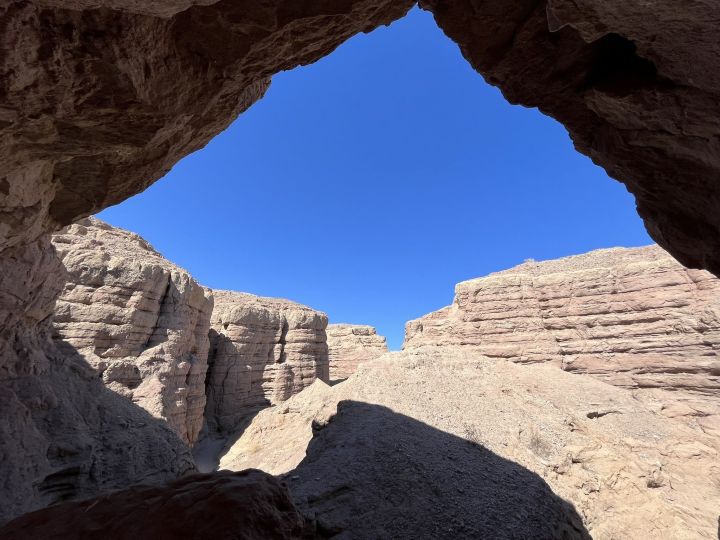
Ladder Canyon and Painted Canyon Trail is a hidden gem trail that's perfect for exploring during the winter. Here you'll find fascinating rock formations as well as slot canyons, ladders you can climb on, and even rock walls with art painted on them. Information on AllTrails states that this trail should be done clockwise so that you climb ladders going up instead of down. That's a great tip!
14. Badwater Basin Salt Flats Trail
- Location: Death Valley
- Mileage 1.9-mile out-and-back trail
- Difficulty: Easy
- FYI: This easy trail in Death Valley National Park is flat and will take well under an hour to complete. October through March are the best times to visit. The trail is paved and boardwalk and is both wheelchair and stroller-friendly. However, it's not dog-friendly! Dogs are not allowed here. The park charges a fee to enter as it is a National Park. However, if you have a National Parks Pass, there's no charge.
Death Valley National Park is home to the lowest point in North America. And that lowest point is Badwater Basin at 282 feet below sea level. The basin has a high accumulation of salt which makes for an ultra-interesting place to visit. You'll see dried salt and can even walk out onto the salt flats. If the Badwater Basin Salt Flats are not yet on your bucket list, they should be!
15. Bump and Grind Trail
- Location: Palm Desert
- Mileage 4-mile loop trail
- Difficulty: Moderate
- FYI: This hike through Santa Rosa and San Jacinto Mountains National Monument is best from October through May and will take nearly 2.5 hours to complete. Leave your pups at home -- dogs are not allowed.
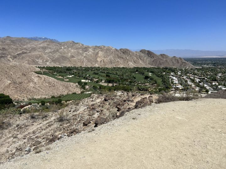
The Bump and Grind Trail is well-marked and easy to follow. It also leads to some pretty darn spectacular views! There's not much cover so make sure you bring plenty of water and sun protection. It gets hot here in the summer which is why it's best to hike this trail in the winter. Also, be on the lookout for mountain bikers who share this trail with hikers.
Santa Rosa and San Jacinto Mountains National Monument is not only home to some epic hiking trails but the Palm Springs Aerial Tram. Why not take a ride on one of the famous rotating tram cars?
Best Hikes Near Los Angeles
Los Angeles is SoCal’s largest city. This sprawling metropolis covers 502 square miles and you better believe there are tons of places to go hiking here! From the Santa Monica Mountains to the Pacific Coast, the Hollywood Hills, and over 180 parks, you can spend all day every day outside in and around the city proper. So, in case you were wondering, here are some of the best hikes in Los Angeles:
16. Inspiration Loop Trail
- Location: Pacific Palisades
- Mileage 4.4-mile loop trail
- Difficulty: Moderate
- FYI: Will Rogers State Park does not allow dogs, so please leave them at home. There is a charge for parking. This loop trail has an elevation gain of 793 feet and will take just over 2 hours to complete. The trail is overgrown in some areas.
Will Rogers State Park is one of the most beautiful state parks in Southern California and a worthwhile one to visit. Take the Inspiration Loop Trail and you'll be rewarded with beautiful vistas of both the Pacific Ocean and Los Angeles we well as a lovely sea breeze. Once you get to Inspiration Point you'll probably want to stay a while. You may want to take a picnic with you to enjoy at the top!
17. Betty B. Dearing Mountain Trail
- Location: Studio City
- Mileage 5-mile out-and-back trail
- Difficulty: Moderate
- FYI: This trail at Fryman Canyon Park will take around 2 hours to complete with an elevation gain of 971 feet. Hiking here is optimal year-round. Dogs are allowed and can be off-leash in some areas.
For forest and city views, a hike at Fryman Canyon Park is simply perfect. The Betty B. Dearing Mountain Trail is a fascinating hike through the forest, canyons, and past springs. You'll be able to see why it's a popular trail for hikers as well as equestrian riders. Mountain bikes are not allowed so at least you won't have to worry about them!
18. Hollywood Sign via Canyon Drive
- Location: Los Angeles
- Mileage 6-mile out-and-back trail
- Difficulty: Moderate
- FYI: Set aside 3 hours to hike to the Hollywood Sign. Located within Griffith Park, there's an elevation gain of 1,171 feet. Parking can be found at a lot on Canyon Drive. Dogs on leash are allowed.
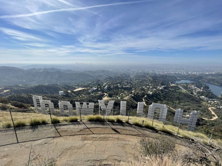
You cannot mention Los Angeles without thinking of the Hollywood Sign. This iconic sign is a landmark situated on Mount Lee -- and you can hike to it! This is one of the most popular hikes in the city but it's so worth it. Once you get to the top, your vantage point will be from behind the sign. Make sure you take a camera with you as this Hollywood Sign is a historic part of the city.
What other hikes do you believe are the best hikes in Southern California? Let us know in the comments. For information on all of these Southern California trails and more, be sure to download the AllTrails+ app!
Need help packing for your next hiking adventure? Check out our Ultimate Hiking Packing List.
OnlyInYourState may earn compensation through affiliate links in this article. As an Amazon Associate, we earn from qualifying purchases.
More to Explore
Best Hikes In Southern California
Does Southern California have good hiking trails?
With great weather in most parts of the region, yes, Southern California has good hiking trails that can be used year-round. Some of the best hiking trails include the following:
- Deep Creek Hot Springs Trail in the San Bernardino National Forest
- Heart Rock Trail in the San Bernardino National Forest
- Holy Jim Canyon Trail in the Cleveland National Forest
- Icehouse Canyon to Cucamonga Peak Trail in the Cucamonga Wilderness
- Iron Mountain Trail in Poway
Of course, you can explore close to where you live in Southern California and find some amazing trails. You never have to go too far for a hike!
What are the best months to hike in Southern California?
Any month is a good month to hike in Southern California. But for optimal weather and temperatures, September, October, and November are ideal months to hit the trails. Spring is also a wonderful time especially if you wish to see spring flowers in bloom like the famous poppy super bloom at the Antelope Valley California Poppy Reserve.


