
The 30-Mile Hike To Reach South Carolina's Very Own Grand Canyon Is Worth Every Step

Robin Jarvis
Author
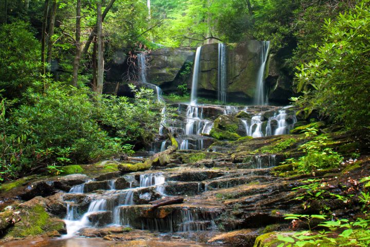
One of the best trails in South Carolina clocks in at 77 miles and takes hikers on an unbelievable adventure through the mountains and the foothills of the Palmetto State. The trail, called the Foothills Trail, drops down into South Carolina’s very own Grand Canyon, known as the Jocassee Gorges. It has shorter segments with easily accessible entry and exit points allowing the trip to be broken down into shorter, smaller treks.


Related Stories
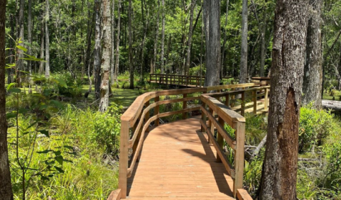
An Expansive Preserve With Boardwalk Trails And Natural Paths, Caw Caw Interpretive Center In South Carolina Is A Must-Visit
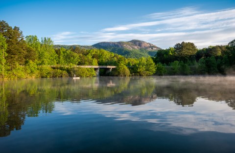
Explore 3,083 Acres Of Unparalleled Views Of Mountains On The Scenic Lakeside Trail In South Carolina
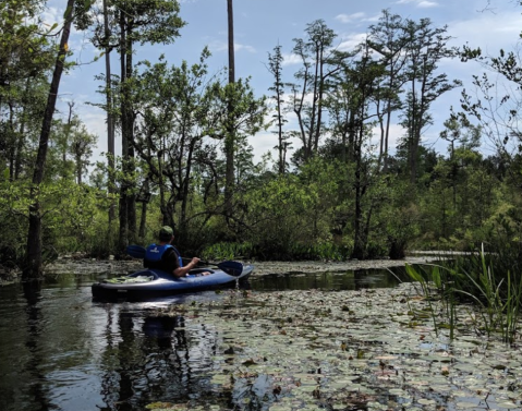
This Little-Known 3-Mile Canoe Or Kayak Trail Through Cypress Trees In South Carolina Is A Paddler's Dream Come True


Fantastic views, water features, waterfalls, and suspension bridges are the earmarks of this awesome trail in South Carolina. The trail is clearly marked and includes linkups to many other trails that cross its path. Have you hiked it or parts of it before and explored South Carolina’s very own Grand Canyon? Let us know about your experience in the comments!
Learn more about the A4 – A8 segment of the Foothills Trail from our friends at AllTrails. The website and app ranks this trail as “moderate” in difficulty. The overall elevation changes on the A4 – A8 hike total 6,564 feet.
If this trail is a bit more than you have time for or can handle with your experience level, then keep reading: 7 Of The Greatest Mountain Hiking Trails In South Carolina For Beginners!
OnlyInYourState may earn compensation through affiliate links in this article. As an Amazon Associate, we earn from qualifying purchases.