The Incredible Oklahoma Hiking Trail That Takes You Past Ancient Lava Flow
By Catherine Armstrong|Published April 15, 2019
×
Catherine Armstrong
Author
Writer, editor and researcher with a passion for exploring new places. Catherine loves local bookstores, independent films, and spending time with her family, including Gus the golden retriever, who is a very good boy.
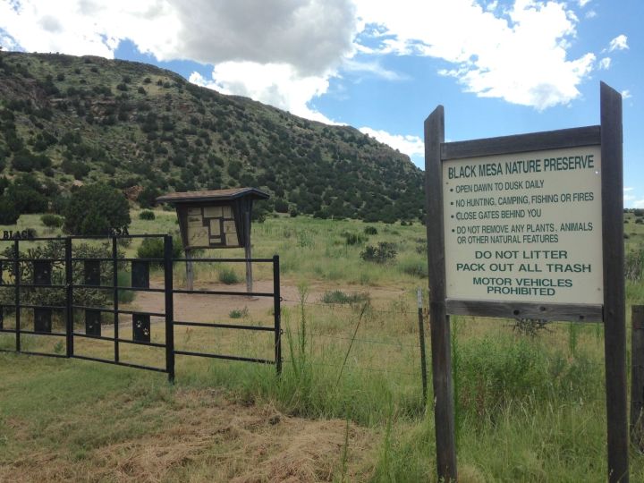
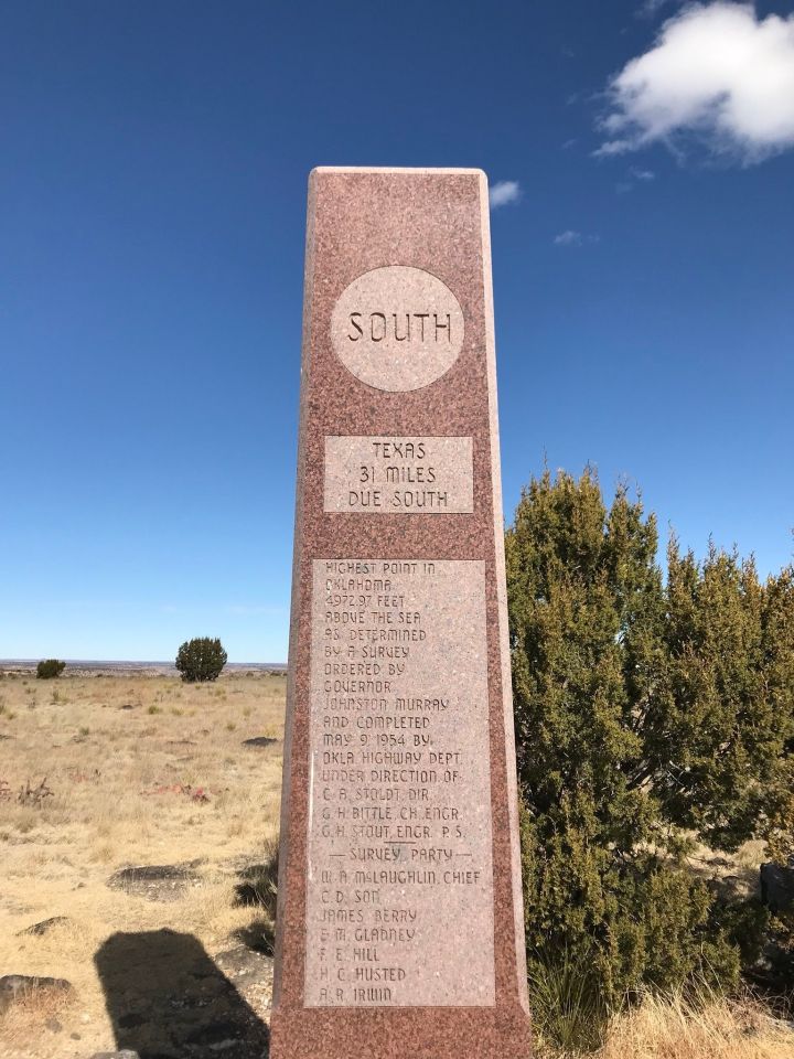
You’ll feel like you’re on top of the world on Black Mesa, the highest point in Oklahoma. This spot stands at an elevation of 4,973 feet above sea level, and it also boasts some interesting geography. Did you know that three to five million years ago, a volcanic eruption created this mesa? You can take a hike to see some incredible views, and see the lava flow close-up.
Black Mesa is a plateau that stretches for 28 miles from Colorado, into New Mexico and across the border into Oklahoma. It was formed by a volcano millions of years ago, and you can still see remnants of the lava flow that created it.
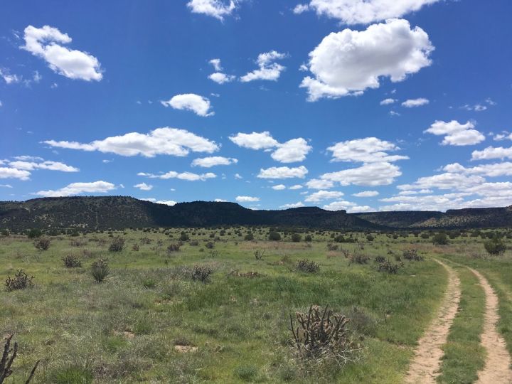
The trail is considered moderately strenuous, so make sure you're up for the task before you get started. You'll want to carry plenty of water with you on this hike. The beginning of the trail follows a Jeep track, and starts to slowly climb. Your elevation climb is just over 700 feet total during the 8.5-mile out-and-back hike.
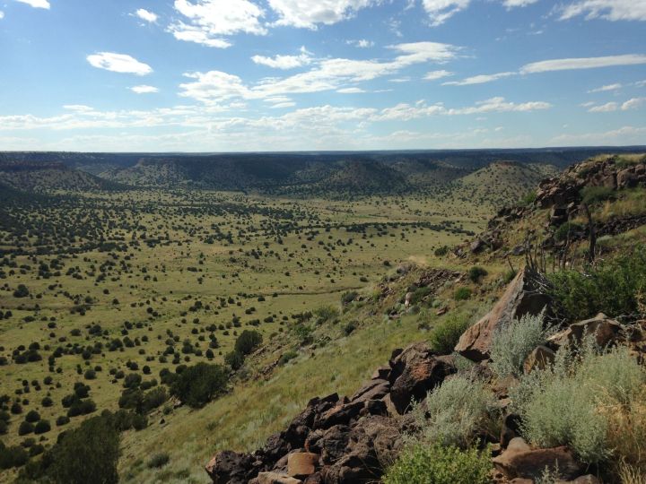
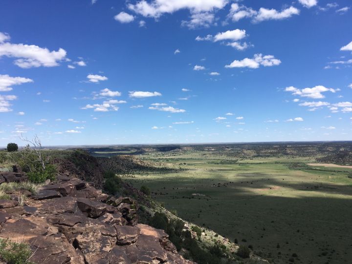
Along the way, you'll enjoy some classic Oklahoma scenery with big, blue skies and the butte in the background. Enjoy the first couple miles of the trail, which are fairly flat.
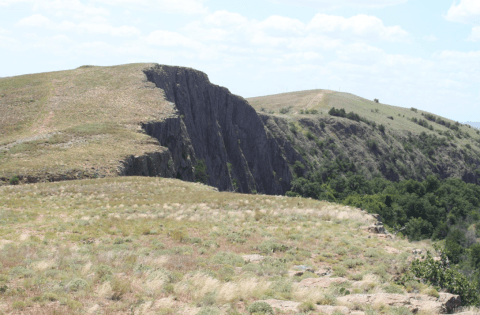
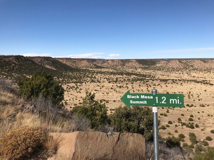
The trail starts to climb as you reach the switchbacks, and this is where the real work begins. Luckily, a sign encourages you to keep going - you're almost there!
You'll see evidence of the lava flow with the basaltic lava rocks that are left here. A huge eruption came from a vent in the Raton-Clayton volcanic field, and filled the entire valley. Millions of years of erosion left just the basalt.