This Northern California Hike Leads To The Most Awe-Inspiring Lookout
By Jill S.|Published March 22, 2017
×
Jill S.
Author
Jill is a freelance writer from a small Northern California town and lives in the Sierra Nevada mountains. If you have an idea for an Only In Northern California story, email her at jsanford@onlyinyourstate.com.
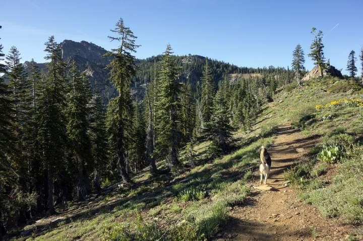
It’s no secret that Northern California has some pretty stellar hikes with some amazing views. This particular hike rises to the top, which is what you will be doing if you decide to hike it! The Sierra Buttes Fire Lookout trail takes you to the top of the Sierra Buttes to a historic and awe inspiring location.
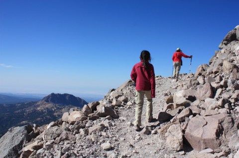
The trail to the Sierra Butte Fire Lookout is rated as moderate. It's a little over 5 miles roundtrip and is a steady ascent from the trailhead until you reach the staircase leading up to the lookout tower.
Located in Sierra County near Sierra City, the Buttes are a less crowded alternative to the Tahoe region and Yosemite to the South. They are equally stunning, however.
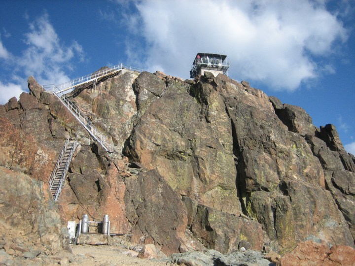
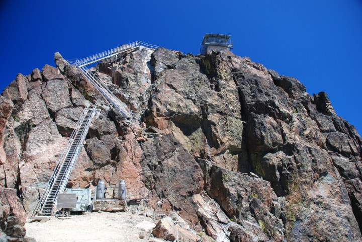
The lookout itself was built as a vantage point for fires in around 1915, one of many in the Tahoe area. The actual completion of the stairs was done in 1964 by five Tahoe National Forest employees during the summer and it made it possible for people to visit the top safely.
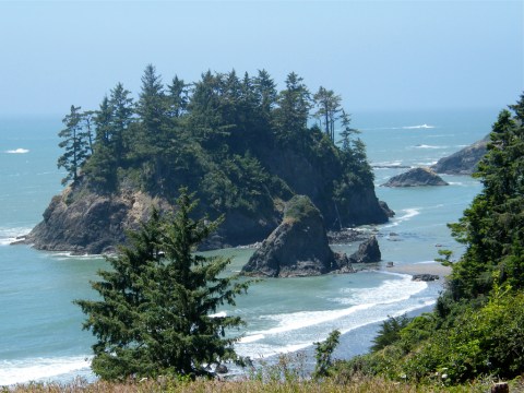
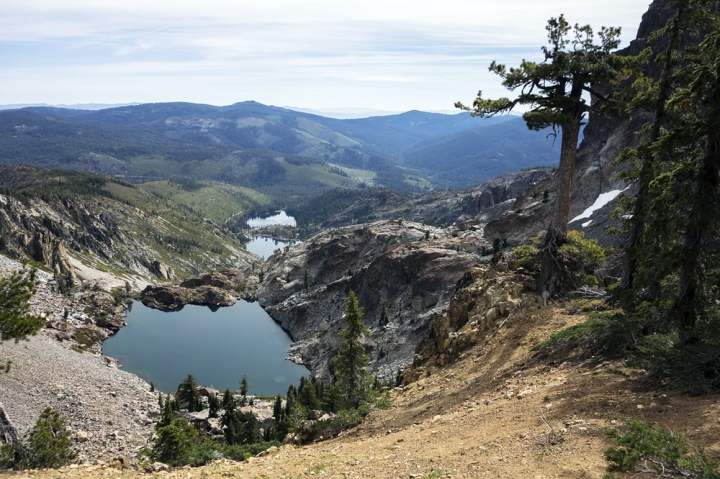
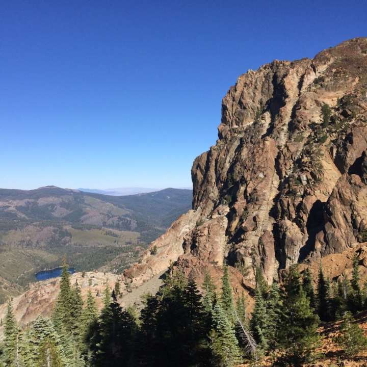
The lookout is located at 8587 feet above sea level. From here, you can take in the views of Upper and Lower Sardine Lakes, the surrounding Sierra Buttes and many miles of Tahoe National Forest.
Make sure you save something in the tank and plenty of snacks and water for that final push to the top. You will be glad you made it when you finally reach the old lookout.
This route is located along the world famous Pacific Crest Trail, which extends all the way from Mexico to Canada. Adventurous hikers can easily turn this into a longer trek than just the 5 miles we recommend.
The views as you climb are spectacular, as well. These three lakes can be viewed from a ridge line about halfway up. The dramatic slopes of these mountains were formed by glaciers.
Even if you haven't hiked to the top of the Sierra Buttes or don't plan to in the future, any Northern Californian can tell you how spectacular they are.
Be very careful once you reach the staircase, especially if you have a fear of heights.
To find the trail, head northeast from Sierra City on Highway 49 for about 5 miles. Turn left on Gold Lake Highway. After 1.3 miles, turn left again on Packer Lake Road. Follow signs for Packer Lake, turning right at the split. Shortly before reaching Packer Lake, turn left on Co Rte 621 (marked with a sign reading: Sierra Buttes). Follow this road up a steep grade until you reach a wide junction with many parking spots (Packer Saddle).
Would you hike to the top of the Sierra Buttes Fire Lookout? The views may be a little dizzying, but the grandeur of the Sierra Buttes will make this hike worth all the effort.
OnlyInYourState may earn compensation through affiliate links in this article. As an Amazon Associate, we earn from qualifying purchases.