
The Remains Of A Lost City Have Just Surfaced In New Jersey And They're Incredible
×

Kristen
Author
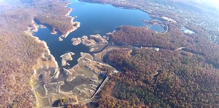
Many of you are probably aware that New Jersey has been going through a serious drought. In fact, it’s the worst drought the Garden State has seen in over 14 years. The water levels at our reservoirs are well below normal and remnants of life before they were built are coming to light.
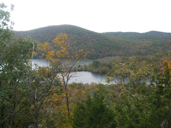
The reservoir was created by the construction of the Raymond Dam in 1928. Established to provide fresh drinking water to nearby residents, it is the second largest reservoir in New Jersey (by volume) and is fed by the Wanaque, Pompton and Ramapo Rivers. It supplies water to nearly 100 North Jersey towns.
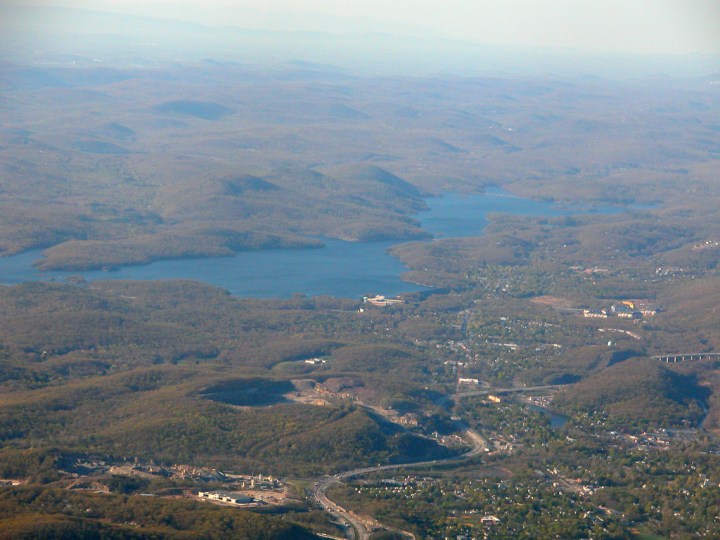
It's surrounded by lush greenery and filled to the brim with water. The scene is quite a bit different now. As of November, the reservoir was at just around 38% capacity.
Advertisement
Related Stories
Someone Flew A Drone High Above New Jersey And Captured The Most Breathtaking Footage
The Sapphire Lake In New Jersey That's Devastatingly Gorgeous

The Underrated Beach With The Whitest, Most Pristine Sand In New Jersey
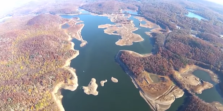
They obtained footage of the Round Valley and Spruce Run reservoirs in Hunterdon County and the Wanaque and Monksville reservoirs in Passaic County. Though the images are shocking, we've also discovered something surprising - up close, one can see remnants of the thriving community that once stood here.
Currently visible are sections of the old Ringwood Avenue, foundations of 19th century homes and the bed for an old train line. Most foundations are visible at the northern part of the reservoir, near Skyline Drive.
Currently visible are sections of the old Ringwood Avenue, foundations of 19th century homes and the bed for an old train line. Most foundations are visible at the northern part of the reservoir, near Skyline Drive.
Advertisement
While you can still see bricks, much more once stood in the area. You could find a paper mill complex, 6 miles of train tracks, 7 miles of roads, farmhouses and vacation villas. There was also a cemetery in this spot, though it was not built over - 256 bodies were exhumed and relocated. In total, about 70 homes and buildings were razed. It's strange to think, not so long ago, a thriving community existed where now just water remains.
To see more footage of the current state of New Jersey’s reservoirs, watch the video below from NJ.com’s YouTube channel. Fast forward five minutes to see the Wanaque Reservoir.
For more abandoned New Jersey, check out my previous post on Ong’s Hat in the Pinelands.
OnlyInYourState may earn compensation through affiliate links in this article. As an Amazon Associate, we earn from qualifying purchases.