
The One Incredible Trail That Spans The Entire State of New Hampshire

Ken MacGray
Author
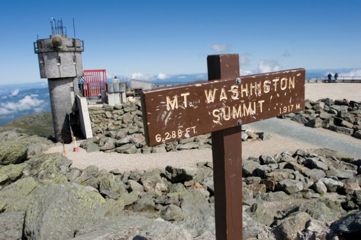
The Appalachian Trail is the longest footpath in the world, stretching 2194.3 miles from Georgia to Maine. Each year, thousands of hikers attempt the trail in one trip, while others hike sections of it. 160.9 miles of the AT pass through New Hampshire, providing plentiful opportunities to walk this historic route and see some of its spectacular sights.


Related Stories

This Is The Most New Hampshire Sound You'll Ever Hear, And We Can't Stop Listening To It

It's An Epic Aerial Adventure Soaring In The Skies Over New Hampshire

The Whole Family Could Spend An Entire Day Having A Blast At Muddy Paw Sled Dog Kennel In New Hampshire


It should be noted that this entire section of the AT does not have to be done all in one go unless you want to of course! All of the destinations mentioned above can be done as day or overnight hikes. For more information, grab a copy of the AMC White Mountain Guide and visit the Appalachian Trail Conservancy website.
If you’re looking for hikes, New Hampshire has you covered! Take a walk to see some great waterfalls or check out these 12 hikes around the state, one for each month of the year.
OnlyInYourState may earn compensation through affiliate links in this article. As an Amazon Associate, we earn from qualifying purchases.