
The Rugged And Remote Hiking Trail In Minnesota That Is Well-Worth The Effort

Trent Jonas
Author
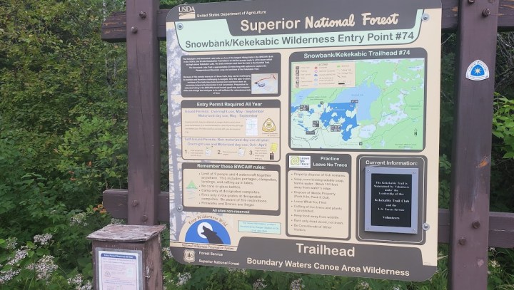
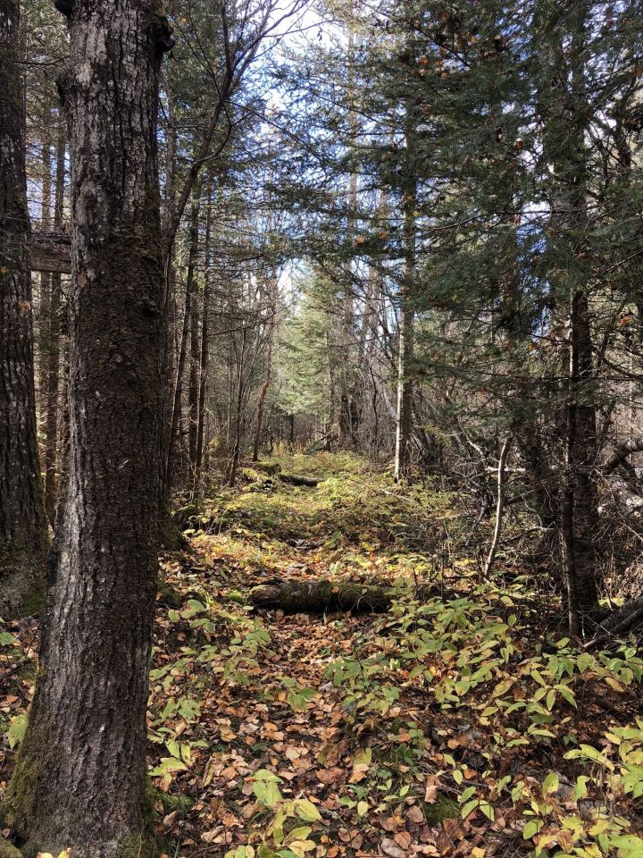
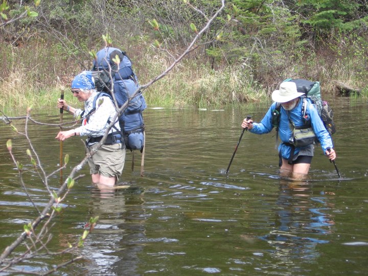
Of the Northstar State’s long and long-ish footpaths, the 40-mile (or so) Kekekabic Trail – or “the Kek,” as it’s sometimes called – is probably the most rugged and remote trail in Minnesota. But those who make the trek are rewarded handsomely for their efforts.


Related Stories
Most People Don't Even Know This Little-Known Destination In Minnesota Even Exists

This Short Minnesota Hike Takes You To A Stair Step Waterfall And The Gitchi-Gami State Trail
Before Word Gets Out, Hike A Portion Of Minnesota's Newest Future Hiking Trail


You will need to obtain a permit – or self-issue a permit between October and April – before hiking the Kek. Visit the Superior National Forest page on the Forest Service website for more information on permits, as well as trail conditions, fire closures, etc. The Kekekabic Trail is, notably, part of the Minnesota section of the North Country National Scenic Trail, which stretches from Vermont to North Dakota. So, it’s kind of a big deal.
Although, at 40-ish miles, it’s shorter than some of the state’s better-known footpaths, like the Border Route or Superior Hiking trails, it is actually more remote. This means you won’t have cell service during much (if any) of your hike. So, you’ll need to download Kekekabic Trail maps onto your device, if you plan to use your phone for navigation. AllTrails+, for example, allows you to both download maps and use the smartphone app for offline navigation. Never rely solely on an electronic device for navigation, though – always bring paper maps with you as backup.
Have you hiked the Kekekabic Trail? Tell us about your experience in the comments!
OnlyInYourState may earn compensation through affiliate links in this article. As an Amazon Associate, we earn from qualifying purchases.