
The North Country National Scenic Trail In Minnesota Is Now A National Park Service Unit

Trent Jonas
Author
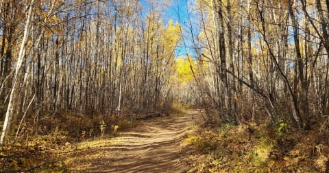
The North Country National Scenic Trail passes through Minnesota, from the Wisconsin border to the North Dakota border, connecting several other trails along the way. In December 2023, the North Country Trail in Minnesota – along with the other seven states it traverses – became a unit of the National Park Services. This should mean some changes for this longest of the national scenic trails – for the better.


Related Stories

The Little-Known Natural Wonder In Minnesota That Becomes Even More Enchanting In The Wintertime
The Iconic Hiking Trail In Minnesota Is One Of The Coolest Outdoor Adventures You’ll Ever Take
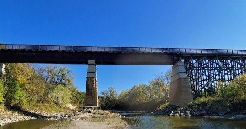
Crossing This 120-Year-Old Bridge In Minnesota Is Like Walking Through History

The remainder of the NCT in Minnesota is a combination of road walks and trails through the Chippewa National Forest, several state forests, Itasca State Park, Detroit Lakes, and Fergus Falls. The NCT crosses into North Dakota at Fort Abercrombie State Park, west of Kent, Minnesota.
The new NPS designation should help to connect the trail, as well as add more trailheads, campsites, and other infrastructure in Minnesota and elsewhere. If you’re interested in learning more, you can pick up a guide to the North Country National Scenic Trail’s Minnesota section – Guide to Hiking the North Country Trail in Minnesota: Across Prairies, the North Woods, and the Wilderness – from Bookshop.org. Have you hiked any segments – or all – of the NCT in Minnesota? Tell us about it in the comments!
OnlyInYourState may earn compensation through affiliate links in this article. As an Amazon Associate, we earn from qualifying purchases.