Explore Minnesota's Scenic 57-Mile Gunflint Trail On This Unforgettable Winter Adventure
By Trent Jonas|Published January 31, 2023
×
Trent Jonas
Author
Trent Jonas came to Minnesota to attend college - and never left. He's a Twin Cities-based writer with a BA in English and a MFA in creative writing, a Minnesota Master Naturalist, and the proud father of two adult children. With more than a decade of freelance writing experience under his belt, Trent is often out exploring his favorite topics: Minnesota's woods, lakes, and trails. Rhubarb pie is his weakness, so discovering new diners is also a passion.
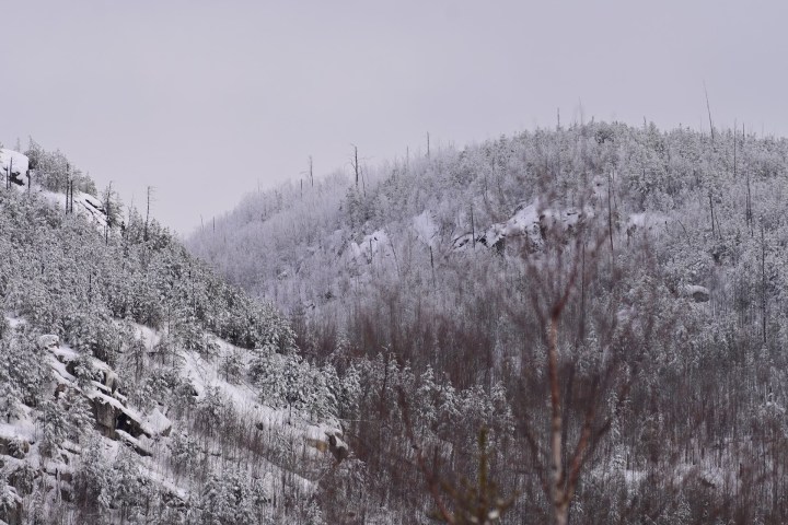
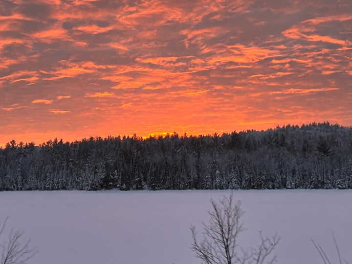
Although many people may associate it with paddling the Boundary Waters and summer hiking or fishing, if you’re looking for a winter adventure in the North Star State, you should put Minnesota’s Gunflint Trail trip at the top of your list. I did just that on one January weekend, and the only thing I regret is not having more time to do and see all there was to experience.
Minnesota’s Gunflint Trail stretches 57 miles from Lake Superior and the charming lakeside outpost of Grand Marais to an arm of Saganaga Lake, which straddles the Canadian Border. The Gunflint, as it’s often called, was designated a National Scenic Byway in 2009, but its history goes back hundreds of years. The route generally follows a footpath once used by Native Americans and fur-trading voyageurs to negotiate the region’s numerous lakes and the challenging peaks of the Misquah Hills. It was first improved as a road in the late 19th century to provide access to an iron ore mine that almost immediately failed. The modern Gunflint Trail was not fully paved until nearly a century later, in 1979.
Now, it’s a gateway to numerous resorts, lodges, and outfitters to the Boundary Waters Canoe Area Wilderness, which the road bisects. Several major footpaths, including the Superior Hiking, Border Route, and Kekekabic Trails, all have trailheads along the Gunflint. The clear, clean lakes are renowned for their fishing opportunities, as well as exploration by adventurous paddlers. But winter takes adventuring on the Gunflint Trail up a notch.
The gateway to the Gunflint Trail is in Grand Marais, on Lake Superior.
But it's not where the sign is located. To get onto the Gunflint, you should head up 5th Ave. W. near downtown, or turn up the Gunflint where it intersects with Minnesota 61, just east of downtown. I prefer to head up 5th Ave. when I'm going up the Trail.
Before starting, though, I armed myself with coffee.
Java Moose is not only my favorite coffee spot on the North Shore, but I'd add it to a Top 10 list of best coffee shops in the state.
Advertisement
It started out life as a seasonal stand next to the Lake Superior Trading Post, but now it's a year-round coffee shop that serves up locally-roasted joe in a cozy, lakefront cafe.
I'm a big fan of Shook Smoothies. Although it is open most days during the winter, I missed its hours on the day I headed up the Gunflint. It's a food (smoothie) truck behind the Harbor Inn, about half a block from Java Moose. Its concoctions, alone, are worth a trip up the shore!
The first part of the Trail is a steep climb toward the Lake Superior uplands. I stopped at the Pincushion Mountain overlook, just past the iconic "Gunflint Trail" water tower on the left side of the road.
The nearby George Washington Pines Winter Recreation Trail - just before you reach the "Guardians of the Gunflint," towering white pines on either side of the road - is a great short trail for beginners, as well snowshoers and skijorers.
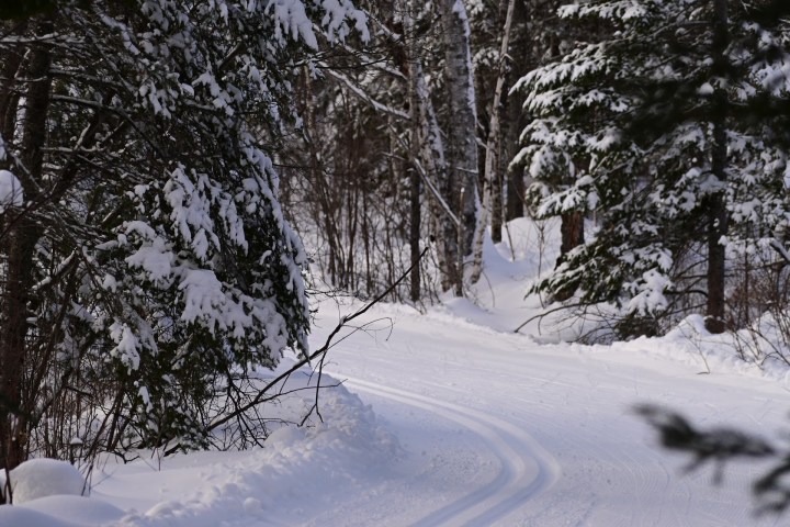
With more than 400km of groomed trails, the network includes the Upper and Central Gunflint systems, as well as the Banadad Ski Trail.
Passes are required for the trails. I picked mine up at Bearskin Lodge - you'll see the sign on the right-hand side of the road as you head up the trail. Passes are also available at Gunflint and Golden Eagle Lodges, as well as a handful of other area resorts. The Banadad requires a Minnesota Trails pass from the DNR.
Bearskin Lodge's Nordic Center is an awesome place to start because it offers several levels of trail difficulty and terrain.
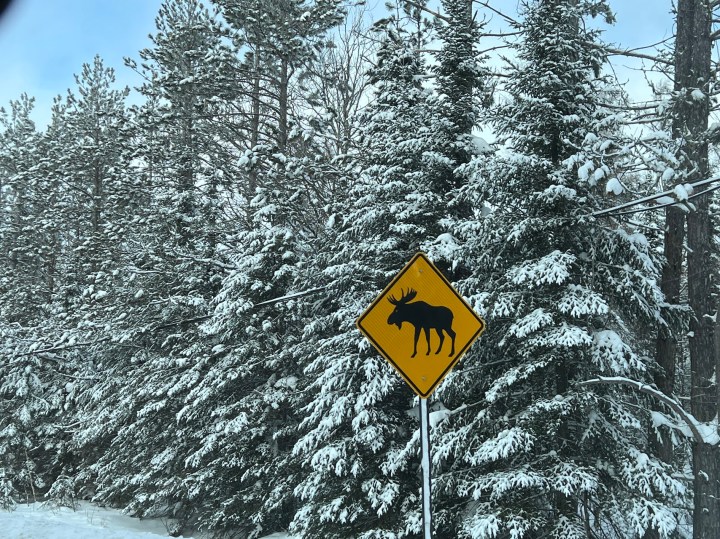
Always be on the lookout for moose and other wildlife on the Gunflint - especially as you approach mid-trail. They're attracted to the road as both a way to avoid deep snow and for the salt that's used to battle ice.
Similarly, snowmobiles often cross Minnesota's Gunflint Trail. Because the mid-trail resorts are so close to the road, you may find yourself sharing the right of way with a sled on occasion.
Mid-trail is always a great place to stop for lunch, and you'll find quite a few options.
Do be careful, though, if you step off the edge of the trail, you could post-hole up to your knee or higher. I did wish I had grabbed my trekking poles for a little extra stability, but I didn't want to go back for them.
The Magnetic Rock trailhead is the western terminus of the Border Route Trail. Hypothetically, I could have gone for another 65 miles. But I only went about a mile out and didn't make it as far as Magnetic Rock, which is about a six-mile round trip.
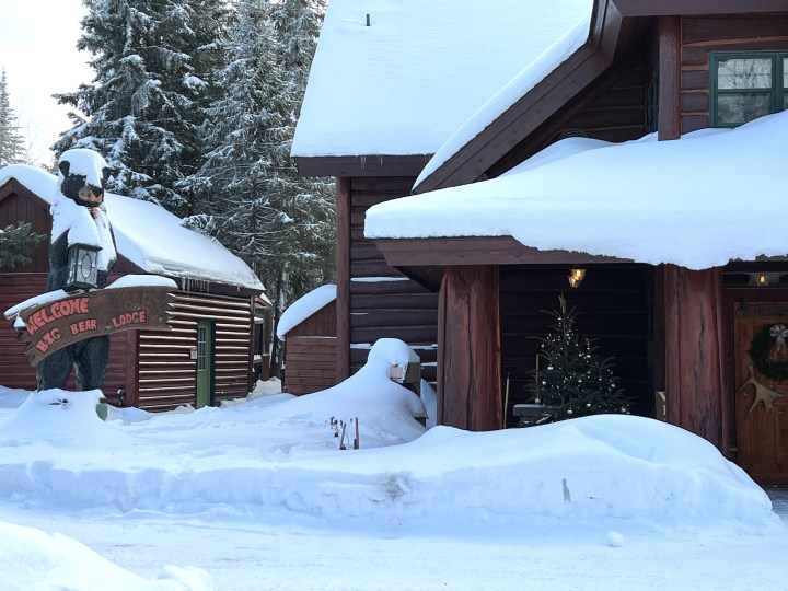
By the time I finished my hike, it was late afternoon and time to check into my lodging for the evening.
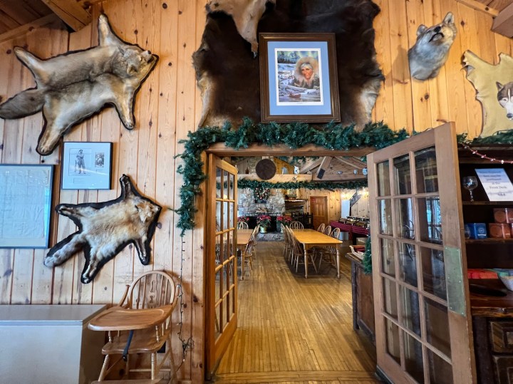
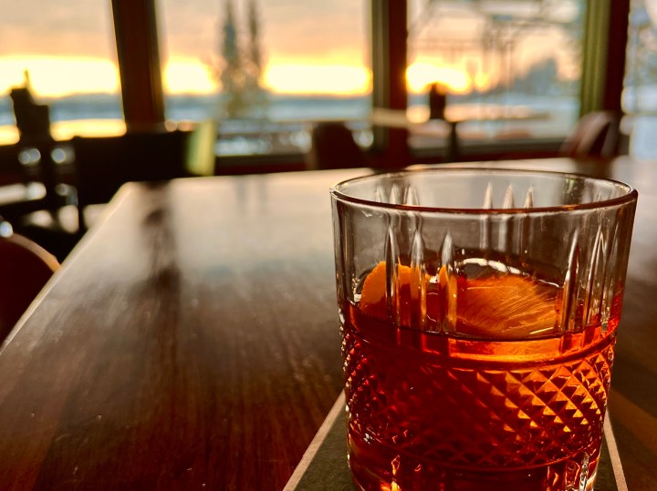
Then, I went back inside and ate a delicious meal next to the massive stone fireplace. A magnificent winter adventure indeed, which you can see more of in this video footage.
And I don’t think there could have been a more fitting way to end my daylong Gunflint Trail trip. What will you do when you visit the Gunflint? No matter what it is, make sure you pack the essentials for winter travel so you are properly prepared for a cold-weather adventure.