
These 15 Aerial Views In Maine Will Leave You Mesmerized
×

Michelle
Author
We all agree that Maine is the most beautiful state in the country, but have we seen it from all angles? I hadn’t until recently when Lawreston Crute of Lawreston Distinctive Views shared a batch of the most gorgeous aerial view photographs taken from a vantage point we don’t get to see very often. After seeing these aerial views, I was curious about what other areas of our state look like from the air. This list is a collection of some of my favorites.
Without a doubt, these aerial view in Maine will leave you mesmerized. I sure was.
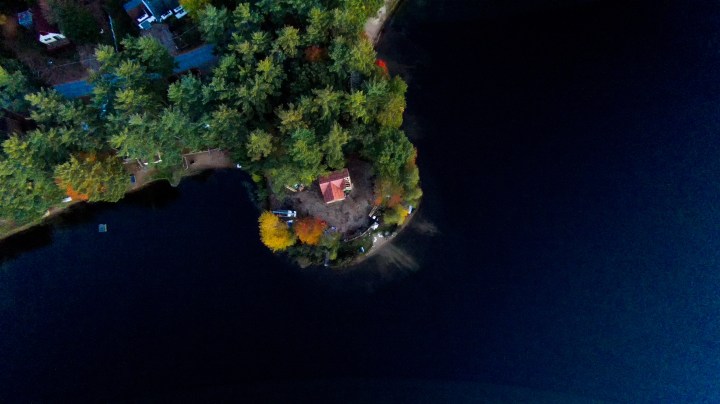
An incredible drone shot of a home on the shores of Loon Pond.
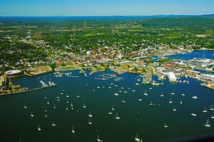
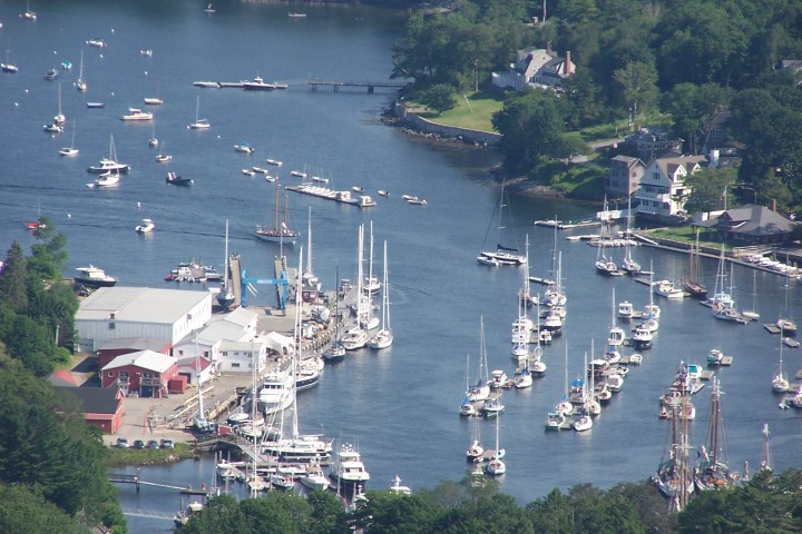
Taken during a flight in September 2015, this photos looks toward Thomaston at the upper left and toward Camden at the upper right.
Advertisement
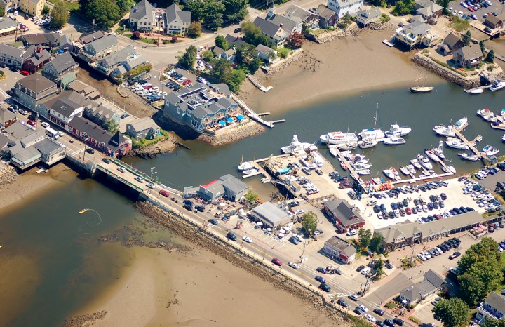
The cars lining up to cross this bridge look so tiny, it almost helps us forget how annoying the traffic can be during tourist season. But tourists, we still love you! Well, as long as you buy our lobster rolls and say nice things about us.
Advertisement
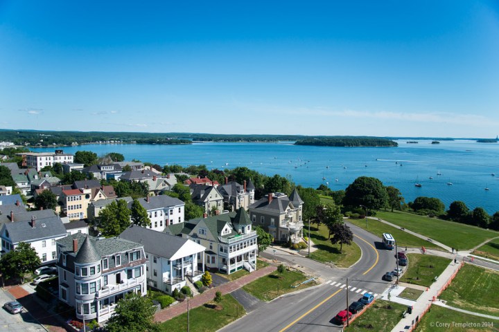
This is one of my favorite places in Portland and it's even more interesting from above. When I win the lottery, I'll be buying two of the homes in this photo. One for me and one for all of you to come visit me!
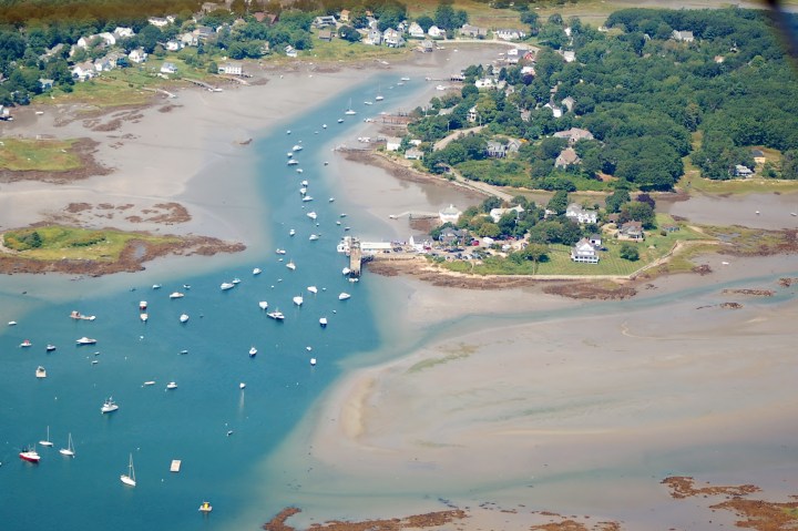
Maine has some of the most dramatic tides in the world. This low tide shot in Southern Maine reflects this perfectly.
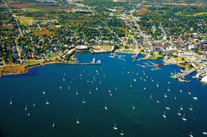
Parts of Maine have been having some absolutely balmy weather, but it's still easy to miss those perfect summer days. This photo was taken on a hot one in July 2013.
This was taken during the same incredible flight that captured the other Rockland aerial view. While it is very similar, it does offer a bit of a closer look at the harbor. We couldn't resist including them both.
Related Stories
These 14 Breathtaking Views In Maine Could Be Straight Out Of The Movies

7 Wonders Of The World That Are Right Here In Maine

16 Terrifying Views In Maine That Will Make Your Palms Sweat
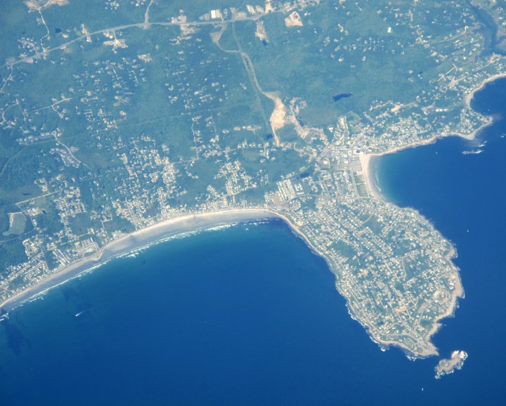
This photo, taken from an airplane bound for New York City from London, shows off Maine's beautiful beaches along with Cape Neddick.
Advertisement
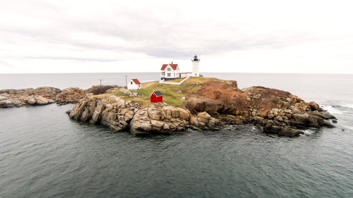
You don't need to go to space for an aerial view that makes Nubble Light look impressive. In this photo, taken by a drone, the contrast of the red against the green and white make this feel like quintessential Maine coast.
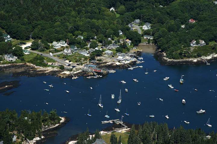
A gorgeous vantage point showing Hen Island and Malden Island. Five Islands Lobster is the red building on the dock.
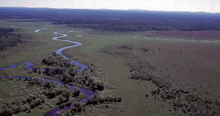
Fourteen miles North of Bangor is Sunkaze Refuge, home to three types of plants, seven bird species, two mollusks and three invertebrates listed as Endangered or Threatened by the State of Maine.
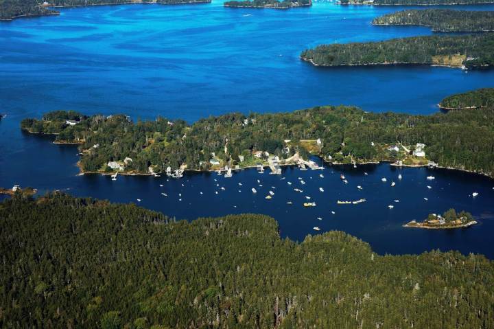
The colors in this beautiful photo remind me of a perfect, deep plaid from L.L. Bean. From bottom to top you can see Gay Island, Flea Island, Pleasant Point Harbor, Pleasant Point and Davis Point. Then, if you look closely, you'll see just a coastal slice of the perfectly agreeable town of Friendship.
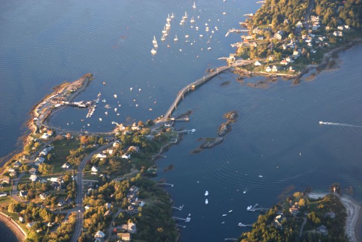
This view of the Cribstone Bridge in Harpswell shows what a year's worth of work in the mid-1920s can accomplish. The bridge connects Orr's Island with Bailey Island.
Advertisement
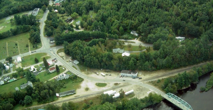
The small town of Peru is captured here from above showing the four corners. Depending on where you're traveling to/from, this might be along the route from Rangeley if you're taking the backroads.
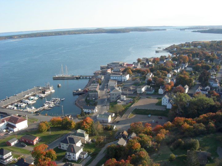
This aerial view of Eastport during the fall of 2007 shows off just how perfect Maine can be in every season. Except maybe mud season. Maine might not be as beautiful as this during mud season.
Share these with someone who could use a different perspective today.
OnlyInYourState may earn compensation through affiliate links in this article. As an Amazon Associate, we earn from qualifying purchases.