
Don't Splurge On A New Coat, Colorado Is In For Another Warm La Niña Winter
×

Annie
Author
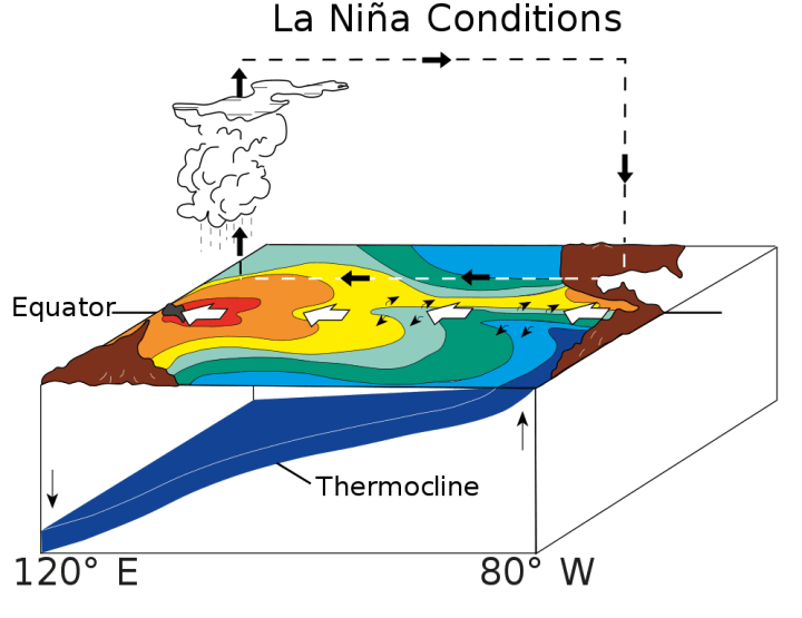
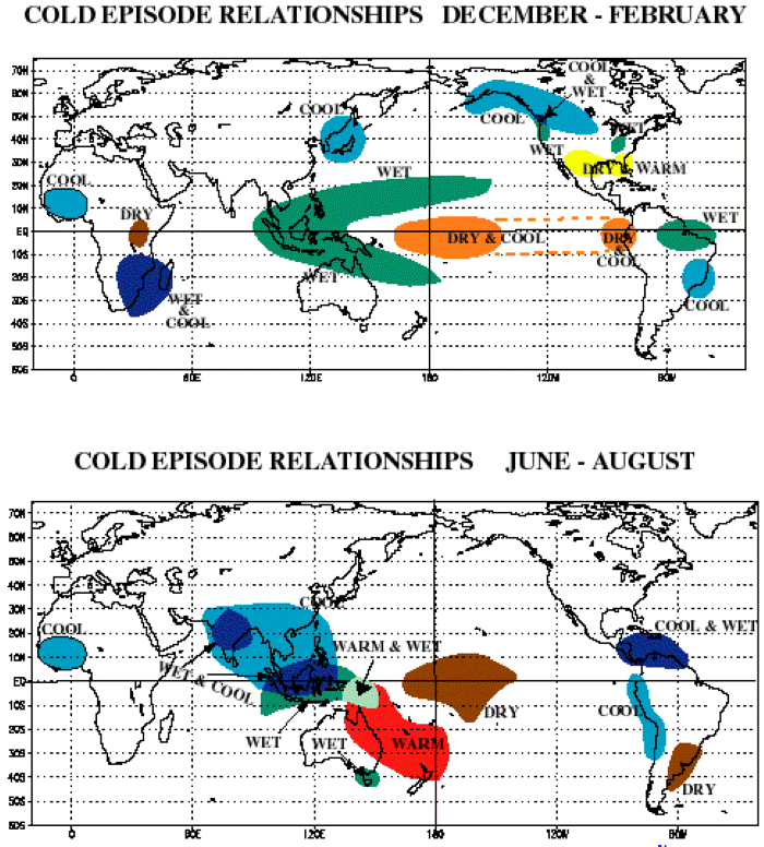
It’s official: Colorado will experience its THIRD La Niña winter in a row, a rare and virtually unseen occurrence in the Centennial State. What exactly does this mean, and what does the La Niña entail? We have the details (including why you shouldn’t need to invest in a new coat):

Advertisement

Advertisement
Related Stories

The Garden Christmas Lights Display At Denver Botanic Gardens In Colorado Is Pure Holiday Magic

The Garden Christmas Light Displays At The Gardens On Spring Creek In Colorado Is Pure Holiday Magic

8 Christmas Light Displays In Colorado That Are Pure Magic
Do you have something that you would like to see featured on Only in Colorado? Nominate it here! Don’t want to think about winter just yet? Then check out This Epic One-Day Road Trip Across Colorado Is Full Of Adventures From Sunrise To Sunset.
OnlyInYourState may earn compensation through affiliate links in this article. As an Amazon Associate, we earn from qualifying purchases.
Featured Addresses
Colorado, USA