These 10 Photos Show The Devastation Of Arkansas' Worst Flood In Decades
By Carol Ann Carson|Published May 29, 2019
×
Carol Ann Carson
Author
Arkansas native, Carol Ann Carson, has written for OnlyInYourState for three years now. She resides in Western Arkansas' Mountain Frontier but calls NWA home as well. The graduate of University of Arkansas - Fort Smith, Carol Ann earned her B.A. in English and will soon be pursing her M.A. in Library Science. She loves exploring the trails around the Buffalo National River and has yet to find a waterfall that wasn't her favorite.
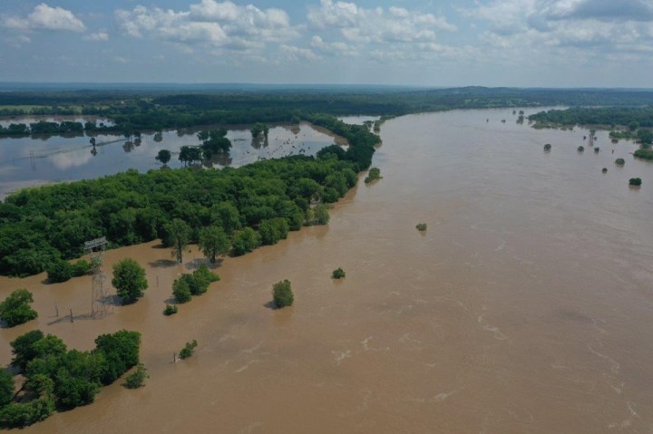
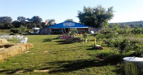
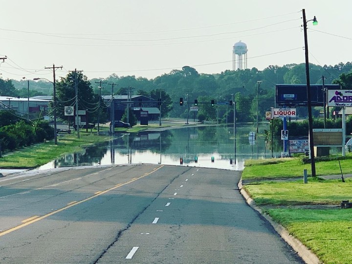
You may know from the news or firsthand, but the Arkansas River has flooded to record levels. Road closures, evacuated neighborhoods, and more rain in the forecast have Arkansans stressed out to say the least. The following photos are only small glimpses into the vast multi-state disaster but they do capture the devastation around Arkansas.
Torrential rainfall in Kansas and Oklahoma have flooded areas all along the Arkansas River.
A couple of factors have lead to this catastrophic swelling of the river. Northeast Oklahoma had over 10 inches of rain in sudden burst of four days. The rainfall in our neighboring states also caused the U.S. Army Corps of Engineers to open the Keystone Dam that sent the swell to Fort Smith. Arkansas, along with most of the south, has stayed saturated from a wet and wild winter as well as heavy storms this spring. To make matters worse, the flooded areas that haven’t seen rain in the past week are projected to have rain over the next few days.
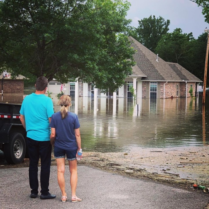
Oklahoma is suffering more directly from the flood but Arkansans have already felt the effects from the creeping river.
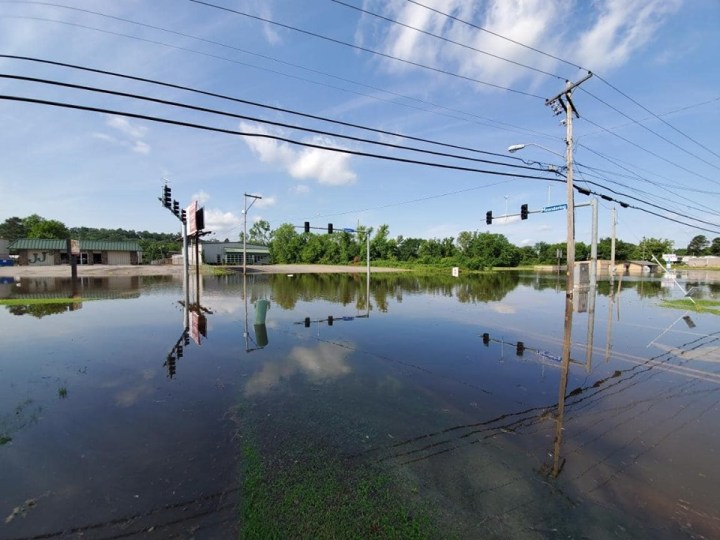
The flood in Oklahoma is completely dislodging houses in some areas while Arkansas is seeing more water damage from water rising into neighborhoods. Hundreds of homes in the River Valley are expect to flood throughout the week.
Advertisement
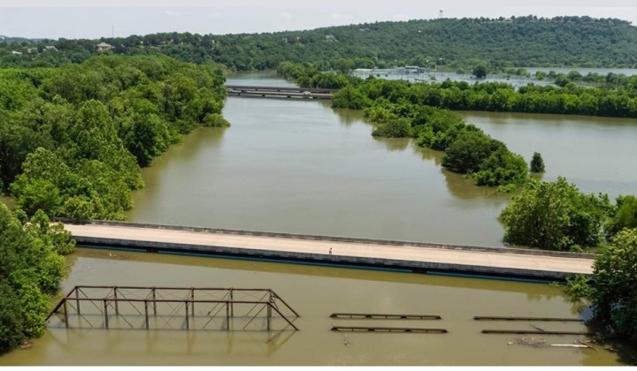
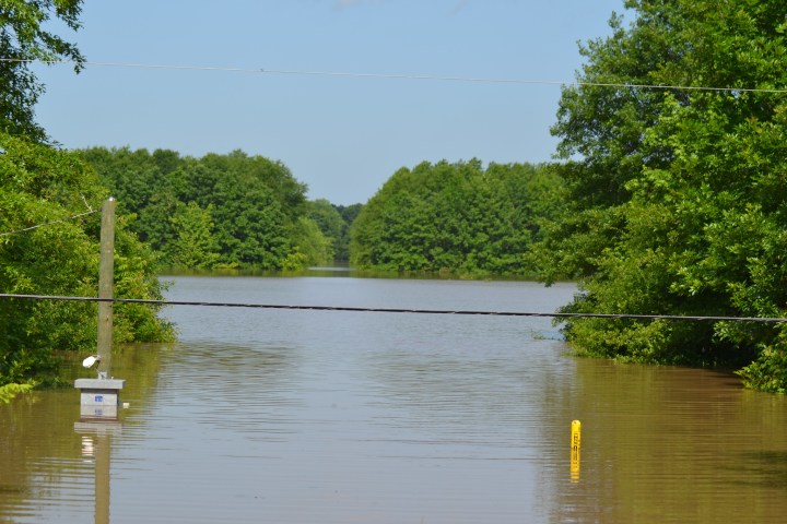
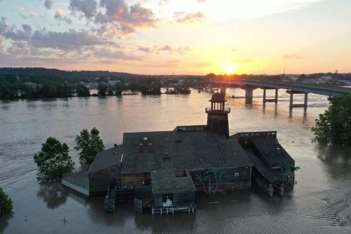
Parts of the river are reaching more than double what's considered a typical flood.
Van Buren for example enters the flood stage at 22 feet but the river is expected to crest between 42-43 feet later this week. This swell will continue down the river and hit Little Rock in the upcoming weeks as well.
Advertisement
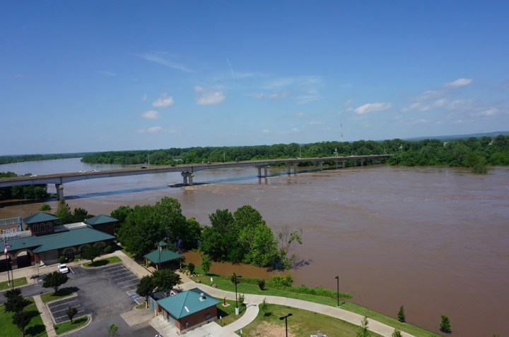
The swell has steadily beat records dating back decades.
The record-setting floods from 2015, 1990, 1927, and 1941 have all been beaten by this week's flood. The most recent record smashed was from the flood in 1945, which was 38.1 feet.
This is considered a 500-year flood, though the title is a bit misleading.
100-year and 500-year floods are terms used to describe the probability of how often they could reoccur. A 100-year flood means there's a 1% chance that it could happen every year, while a 500-year flood only has a .2% chance of happening every year.
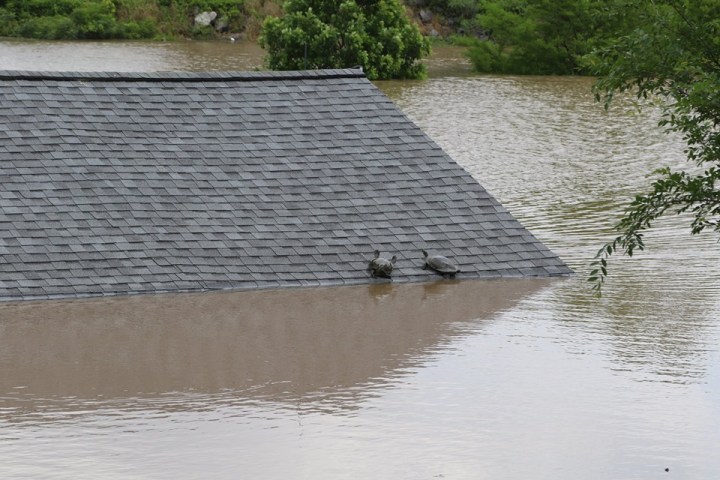
An abundance of animals have been spotted trying to reach higher ground. These critters are surprisingly resilient during these temporary disasters. However, do be on the look out for deer crossing the roads as well as alligators cruising through the water.
The electricity has been shut off in different areas affected by the flood as a safety precaution.
We're left with uncertainty on how long it'll take for things to return to normal but until then we can only hope everyone continues to stay safe. Be sure to stay updated on your local area as the flooding persists. For up-to-date road closures, visit this site.
The flooding is devastating but it’s important to focus on the countless volunteers and businesses working on community relief. This won’t be the first time Arkansans have bounced back from disaster.
Some of today’s photos were features from our Facebook Group, Arkansas Nature Lovers. You can join to see photos of Arkansas’ incredible nature (both the beautiful and the devastating) and share your own.
OnlyInYourState may earn compensation through affiliate links in this article. As an Amazon Associate, we earn from qualifying purchases.