
The Highest Road In Arizona Will Lead You On An Unforgettable Journey

Monica Spencer
Author
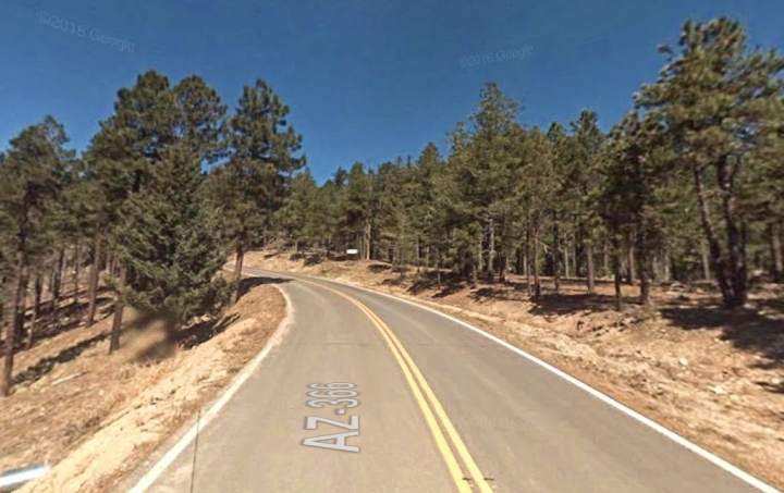
There’s a reason “taking the high road” is not considered an easy task. Have you ever driven a mountain road? Some of them, including those here in Arizona, are often steep, rugged roads with hairpin turns and can even be impassable during certain times of the year. It can be a difficult, slow trek but one that is certainly worth the effort in the end.
Today, we’re going to check out one of Arizona’s highest roads: State Route 366.


Related Stories
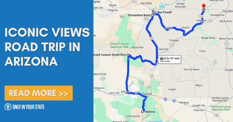
Discover 5 Of Arizona's Most Iconic Views On This Epic 7-Hour Road Trip

The Entire Family Will Love Visiting This Fantastic Farm In Arizona With A Petting Zoo, Animal Feedings, And Monster Truck Tours

The Whole Family Could Spend An Entire Day Having A Blast At The Yard In Arizona


State Route 366 was closed earlier this year due to a forest fire but most of the road has re-opened. You can find details about the road and any closures by visiting the U.S. Forest Service website.
Did this trip inspire you to check out some other fantastic Arizona roads? Check out more of our state’s beautiful scenery when you drive the roads featured in Take These 10 Country Roads In Arizona For An Unforgettable Scenic Drive.
OnlyInYourState may earn compensation through affiliate links in this article. As an Amazon Associate, we earn from qualifying purchases.