The Incredible Alaska Hiking Trail That Takes You Past Ancient Lava Flow
By Megan Shute|Published April 07, 2019
×
Megan Shute
Author
With more than 10 years of experience as a professional writer, Megan holds a degree in Mass Media from her home state of Minnesota. After college, she chose to trade in her winter boots for slippahs and moved to the beautiful island of Oahu, where she has been living for more than five years. She lives on the west side but is constantly taking mini-road trips across the island and visits the neighboring islands whenever she can getaway. She loves hiking, snorkeling, locally-grown coffee, and finding the best acai bowl on Oahu.
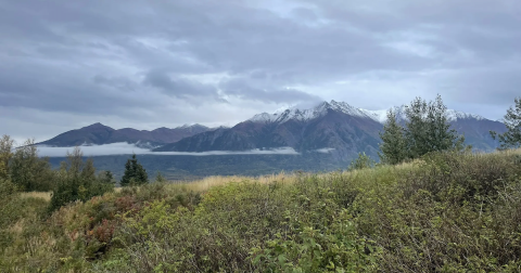
Our big, beautiful state is home to more than 100 volcanoes and volcanic fiends that have been active within the last 1.5 million years. But it’s not every day you get to explore ancient lava flows and a once-active shield volcano up close. If you’re as fascinated with Alaska’s geological origins as much as we are, you’ll want to add this epic volcanic trail to your hiking agenda as soon as possible. Lace up your hiking boots — we’re going on an adventure.
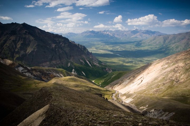
Nestled within America’s largest national park, Wrangell–St. Elias National Park and Preserve, which comprises 13.2 million acres, the Skookum Volcano Trail is an absolute must-visit for all experienced hikers and outdoor enthusiasts in Alaska.
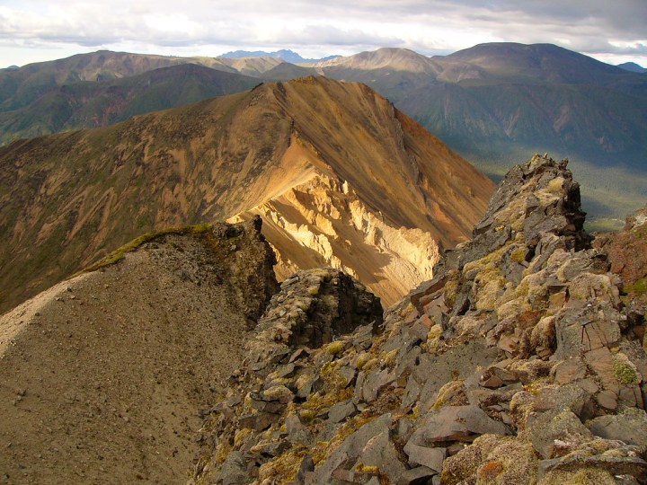
Climbing nearly 1,800 feet through deeply eroded volcanic uplands and ending at a high alpine pass frequented by Dall sheep, this 5.5-mile trail is nothing short of spectacular.
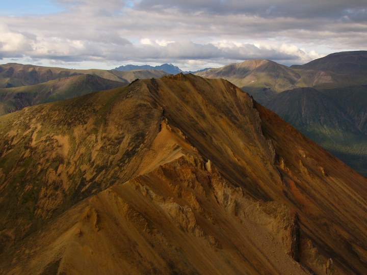
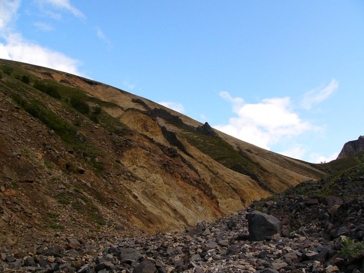
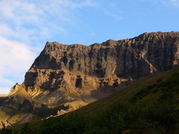
Leading through an extinct and deeply eroded volcanic system, hikers will have excellent opportunities to get up close with picturesque volcanic geology, including rhyolite and dacite domes, andesite lava flows, and vents exposed by erosion throughout the years.
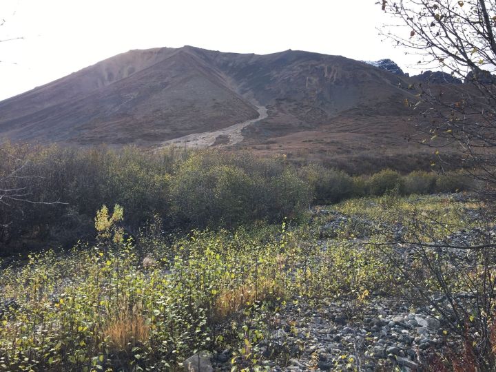
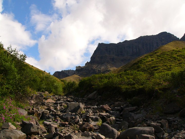
From the trailhead on Nabesna Road at mile 36.8, the trail leads up an alluvial fan through white spruce forest and alder for .8 miles before entering a creekbed where hikers will be required to make shallow creek crossings. When the creek splits to the left approximately one mile from the trailhead, follow the drainage that splits to the left, which leads to the pass.
The path from here is not constructed or maintained due to fragile alpine tundra plants, and you will likely use the rock cairns to mark your way. You might also want to have a map with you.
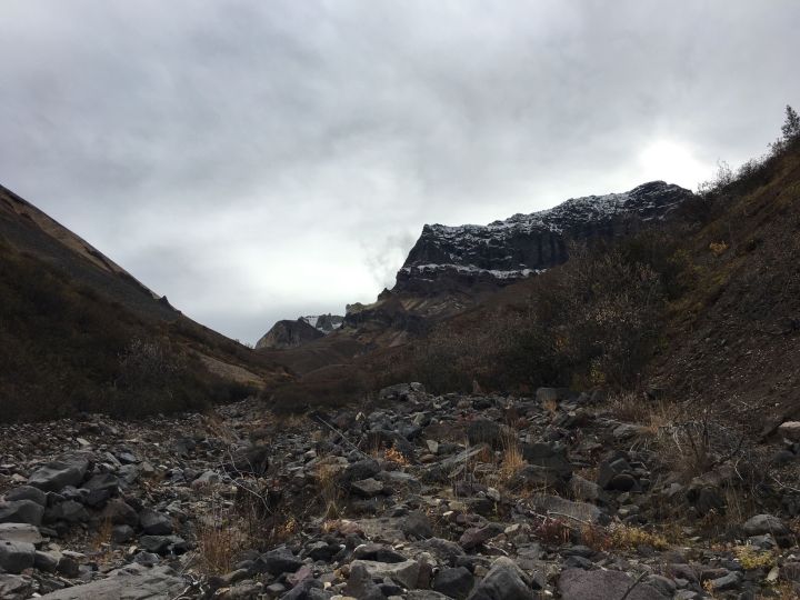
Once you reach the pass, soak in the incredible panoramic views of this heavily-eroded old shield volcano, with its fantastic shapes and colors you might not expect to find in this landscape. Don’t forget your camera.
You now have two options: you can retrace your route back to the trailhead or follow an unmarked cobble creek bed to the south which eventually meets up with Nabesna Road mile 38.3. Here, you will turn left on the road to walk back 1.4 miles to the trailhead.
The entire trail measures in at more than five miles, and you should allocate anywhere from two to four hours to complete it. Wear proper footwear, bring plenty of water and bug repellent, and be prepared for anything. This is the wilderness of Alaska, after all.
The Skookum Volcano Trailhead can be found within the Wrangell-St. Elias National Park & Preserve in Gakona, Alaska. Have you ever embarked on this one-of-a-kind trail before? If so, we’d love to hear about your experience in the comments below. Once you tackle the Skookum Volcano Trail, be sure to mark it off your Alaska bucket list.
OnlyInYourState may earn compensation through affiliate links in this article. As an Amazon Associate, we earn from qualifying purchases.